
Trail Stats
Difficulty: Moderately Difficult to Difficult
Total Mileage/Elevation: 7 mi, 2900ft elevation (approx.)
Location: North flanks of Pikes Peak from Cascade, CO
This Trail is Good for: hiking, backpacking, peak bagging
Dispersed Camping Nearby: no
Forest Service Campground Nearby: no
Pets: yes, on leash
Duration of Hike: 4-5 hours one way. Steep Trail.
Possible Loops: Yes, with Barr Trail
Time of Year I Hiked the Trail: Early August
Time to Nearest Town: Manitu Springs, CO -10 min
Condition of Approach Roads: Hwy 24, lots of traffic
Directions to the Trailhead
Heizer Trail 8210 Anemone Hill Rd Cascade, CO 80809. Take US-24 west past Manitou Springs to Cascade. Turn left at the traffic light that leads into Cascade. Shortly after crossing highway 24 turn left again on Emporia Ave. Turn left again on Park St and then to Anemone Hill Rd. There is a small parking area along the stream at the base of the hill that takes you up to the trailhead. It is kind of a neighborhood so please be careful where you park. You cannot park at the trailhead. It is a private road, please respect this!
Heizer Trail Details
The Frist 2 Miles
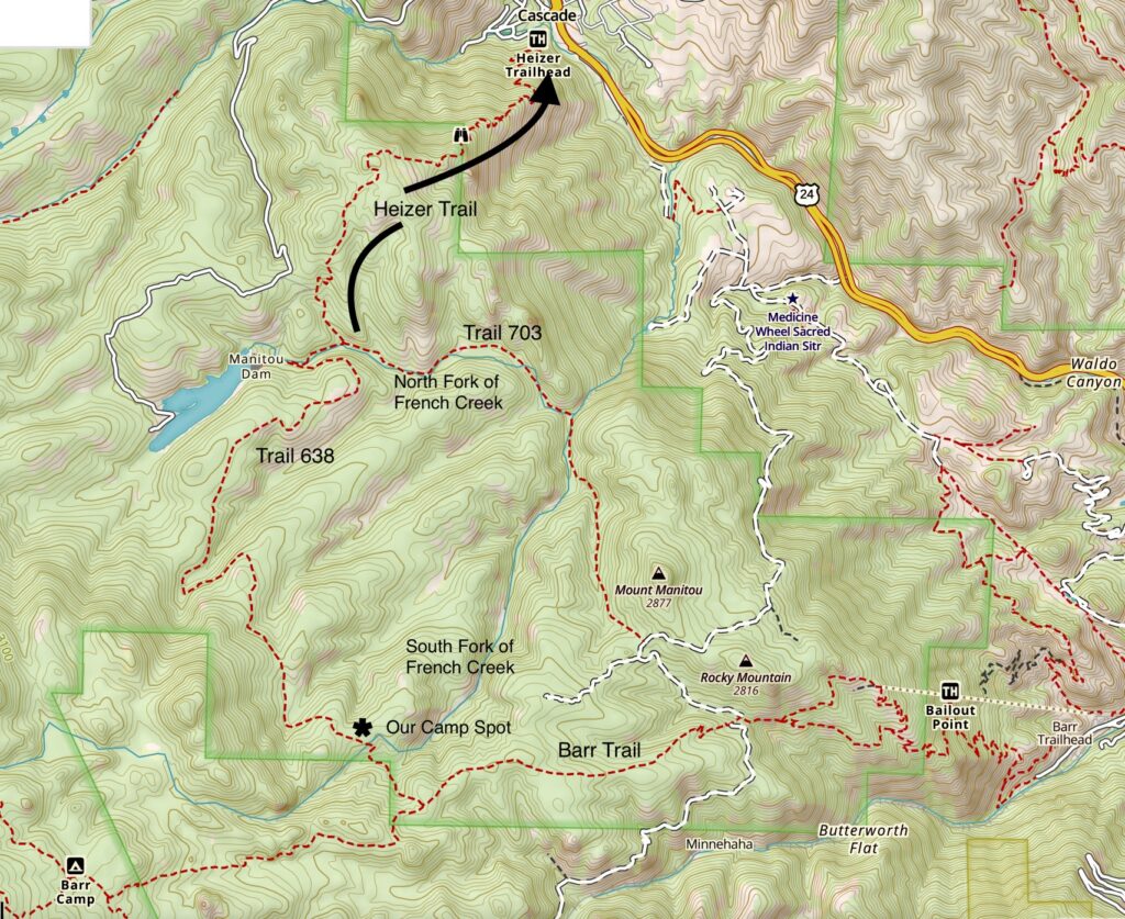
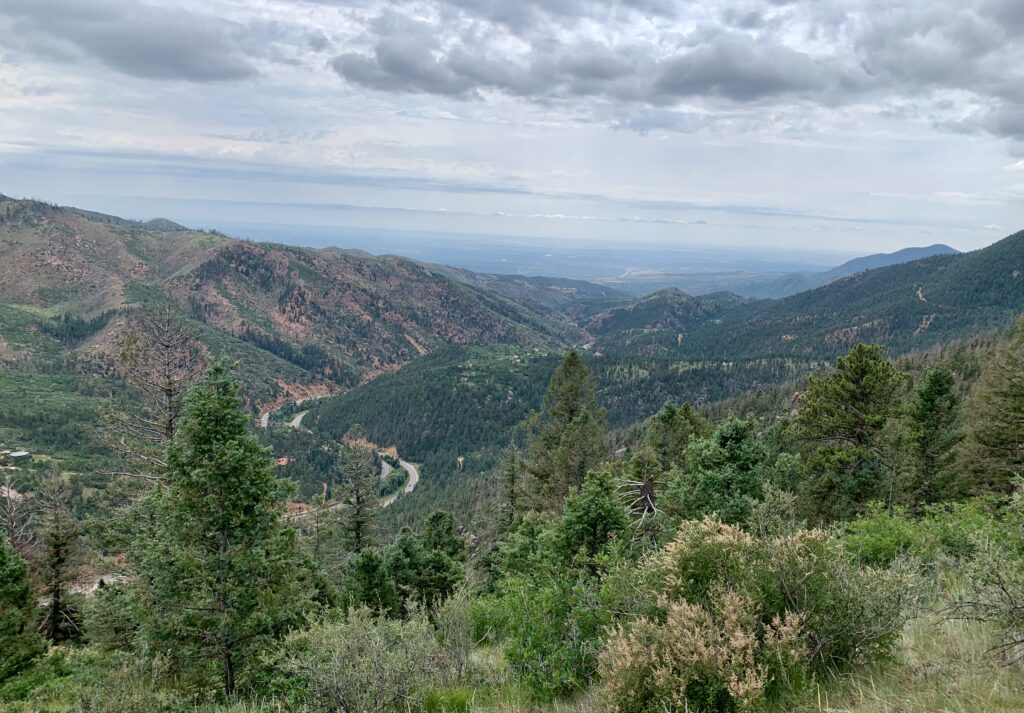
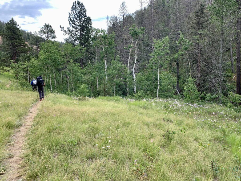
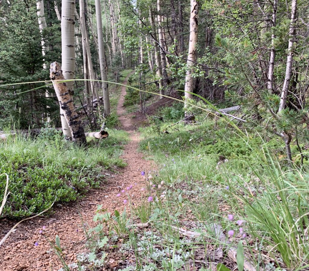
The Heizer trail accesses Pikes Peak from the town, I guess you can call it a town lol, of Cascade. It’s basically a neighborhood along the south side of Hwy 24. The trail climbs steadily and steeply. For being right next to the highway, you are fairly shielded from the traffic noise and you ascend. You’re heading straight up about 1,900 feet over the next two miles so take your time.
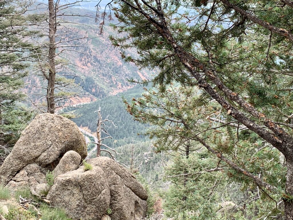
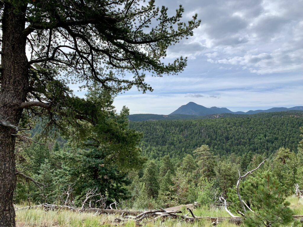
The steepest part of the trail comes a little after a mile in and lasts for about .7 miles to the top of the ridge. Enjoy the many views that are offered, some are fantastic. There is a couple of rest places about a mile and a mile and a half in. You gain the ridge about two miles in, and you’ll know when you do as the trail levels out and you pass several large rock formations and begin to head down before too long.
To North Fork of French Creek
As you crest over the ridge you begin heading south and west-ish across the flanks of the mountain to North Fork of French Creek. From the ridge the trail descends about 500 feet over the next mile to reach the creek. You’ll be walking through aspen and ponderosa pines and large rock formations with good views of Pikes Peak.
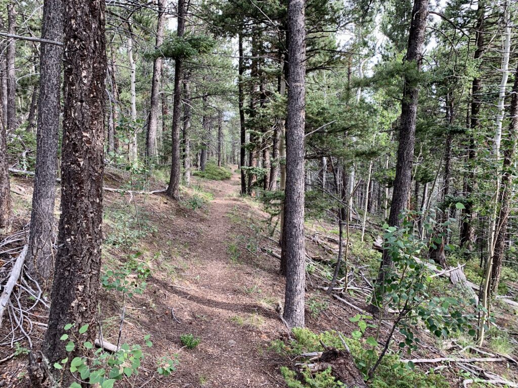
While the trail is definitely more moderate after the first two miles it is constantly going either up or down to some extent as it crosses the ridges coming out east from the mountain. There is approximately another 1000 feet of climbing over the next 5 miles as you through and over these drainages.
As you approach North Fork of French Creek, you will come across a couple of signs. This is where the Heizer Trail ends. One sign will tell you how to get to Hurricane Canyon and Mt. Manitou and Barr Trail. This trail will take you east and loop back around to Barr Trail, you want to take Trail 638 which will access Barr Trail farther up the mountain or farther west up Barr Trail. This trail will take you up the creek to the west and cross it within about a quarter of a mile. There is a sign at the creek crossing as well stating Trail 638 takes you to Barr Trail in 2.5 miles. It is farther than 2.5 miles and more like the 4.0 miles scratched into the sign.
North Fork of French Creek drains out of the Manitou Springs Reservoir. There are signs posted all around the dam asking you not to enter the area. You can see the dam upstream through the trees as you approach the creek. Once you reach the creek it is a good place to stop and rest. There is shade here, and maybe even strawberries if you’re clever enough to sort them out.
North Fork of French Creek to South Fork of French Creek
After you leave North Fork of French Creek drainage you will climb four more ridges and go 3.75 miles before reaching the drainage for South Fork of French Creek. A couple of the drainages you cross between the two creeks have small flows or seeps. South Fork of French Creek the fifth drainage you enter including North Fork of French Creek, or the fourth drainage after North Fork of French Creek. The creek has a strong flow and is about a quarter of a mile below the ridge. If you continue climbing the next ridge past (south) of South Fork of French Creek you will come to Barr Trail about 1.5-2 miles below Barr Camp.
The drainage of south fork of French Creek has some flat spots if you hunt for them, however much of it is marshy, right along the trail, or covered with downfall. We chose to go back up the ridge we had just come down to the north and found some great spots about 100 yards east of the trail along the top. It was flat, had great views of Pikes Peak, free of most debris, free of mosquitoes, a little breeze and kept us up above the coldest air that would settle that night along the creek.
This hike was a great one to do if you just have a short weekend and don’t want to get far from Colorado Springs. There are many places and other trails to explore or link with the Heizer Trail. The Heizer trail had some traffic up to about two miles and then most people turned around. We hiked on a Fri-Saturday (and it was supposed to be rainy) and only saw two groups past the ridge two miles up the trail.
The Descent
I did end up with a black toe from the descent in my tennis shoes. Your choices are tighter lacing, bigger shoes, or an alternative descent. The top of the descent is very steep in places, with loose gravel that makes it easy to slip or fall. The lower part of the descent isn’t quite as bad but is steep enough to make slipping a constant threat. Trekking poles are very helpful going down this trail.
Conclusion
This hike is a fairly difficult trail due to the steepness of initial two miles. The trail after that is only moderately difficult due to the multiple ridges and drainages you cross headed to the intersection with Barr Trail.
It is a fairly good place to go backpacking due to the fairly available water sources, and the ample places to find camping spots. Some of the better spots are not near water, but if you’re willing to pack water a little ways the camping is great. Give yourself water and time to do the climb and this is an enjoyable shorter overnight or even weekend trip.
I enjoyed this hike as it allowed me to see more of Pikes Peak than I had previously done, and with many less people than Barr Trail.
view from the climb up Cascade Mountain 
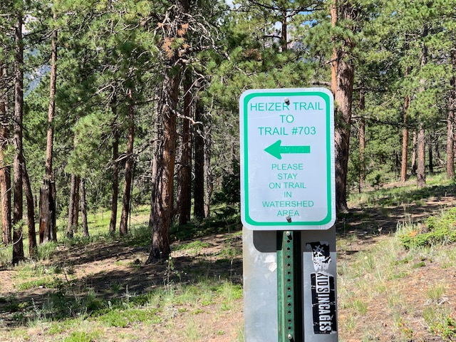
Sign not long after you reach the top of the ridge 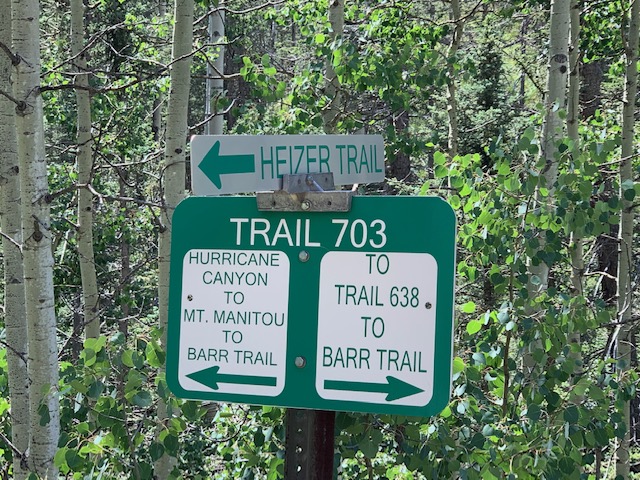
This trail is as you first come up to North Fork of French Creek, you want to take 638 to South Fork French Creek 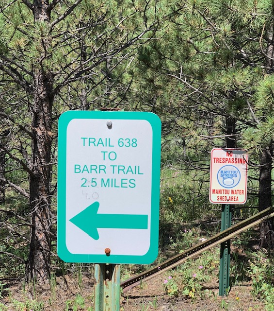
Manitou Reservoir signs and Trail 638 (from Heizer trail to Barr Trail) It is longer than 2.5 miles
Where to Get Maps for This Hike
USGS Online Map Store : I didn’t find the USGS maps very helpful for this hike. The Cascade map is too small of a scale to really be useful.
CalTopo Online Mapping Software- https://caltopo.com/map.html
Gaia GPS – https://www.gaiagps.com/login/?next=/