Total Mileage/Elevation: 2+ almost none. There really aren’t many trails, but you can walk wherever you want to look. This is best done in winter as there is lots of undergrowth.
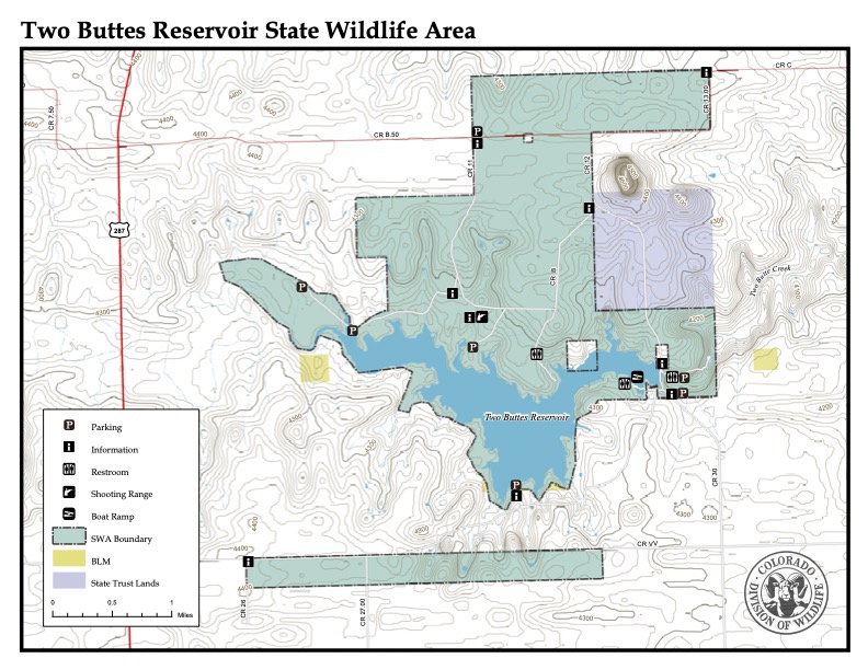
Location: Northwest of Two Buttes. 3 Miles east of 287 on Rd B.5
This Location is Good for: Hiking, Walking, horseback riding, birding, hunting
Dispersed Camping Nearby: Camping just above the creek off of the access road. Designated area. Also by the reservoir and black hole area.
Forest Service Campground Nearby: None nearby
Pets: yes
Duration of Hike: 1+ hours
Possible Loops: you could walk all the way from here to the black hole area if you wanted to up the creek, along the reservoir, and to the Black Hole on the far eastern end of the SWA.
Time of Year I Hiked the Trail: early June. Although I would recommend Nov-May. Always watch for creepy crawlies with so much undergrowth on warm days.
Time to Nearest Town: Springfield is about 30 minutes away. Two Buttes is about 20.
Condition of Approach Roads: Well maintained gravel roads.
Directions to the Trailhead: Go north from Springfield on Hwy 287 about 18 miles to county Rd B.5. You will be getting close to the windmills. Turn right or east onto the gravel road and go 3 miles to the SWA. From here you can continue east to the reservoir and black hole or go a bit south and back to the west to get to the creek above the dam. See the map below.
Trail Description:
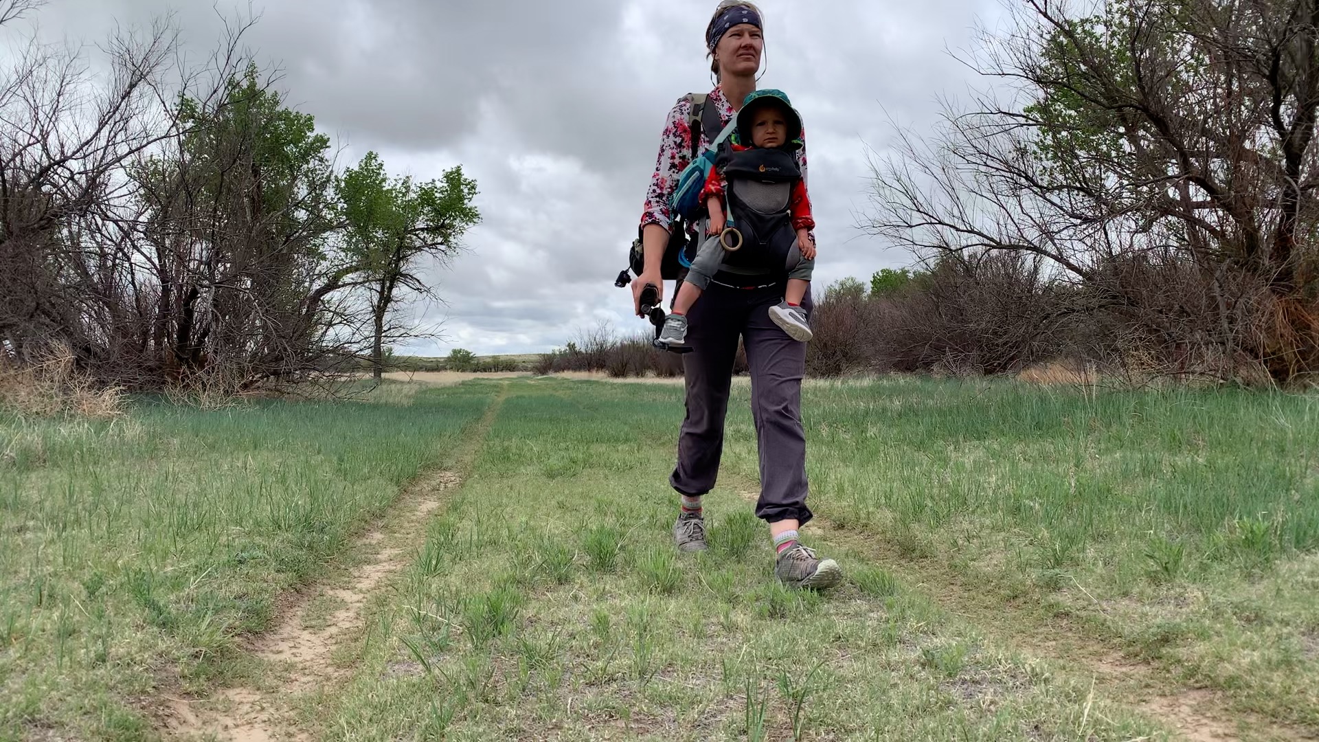
The Two Buttes State Wildlife Area (SWA) is large. It comprises of 8,533 acres. Which makes this place a great place to visit. Not only is it large but it varies greatly in topography. For this hike, I drove to the far western end and the far western parking area. This road could get muddy when its wet. There are two parking areas that make it easy to access the creek in this area. There are a couple of roads that looks like they are mowed for the most part to allow walking as there’s no motor vehicle access past this area.
I hiked along the road that led south to the creek and then in a loop along the creek and back to the parking area. You could continue to go east along the creek if you wanted.
It was a great place to bird with lots of big cottonwood trees and bushes. I will probably be back in the spring to check it out again. I might even try hiking from the west end to the black hole. You could camp around the reservoir if you wanted to make it an overnight. Looks like it could be fun.
NOTES:
- This is an area that could get hot in the summer so if you visit at that time expect mosquitoes, tall weeds and heat. I prefer to hike in the region in the fall, winter and spring.
- Everyone 16 or older needs a valid hunting or fishing license or SWA pass to access the state wildlife area.
Where to Get Maps for This Hike:
USGS Online Store: https://store.usgs.gov/product/49440
CalTopo Online Mapping Software- https://caltopo.com/map.html
Colorado Parks and Wildlife Contact Information:
Colorado Parks and Wildlife Office in Lamar: 719-336-6600
http://cpw.state.co.us/swa – look up Two Buttes