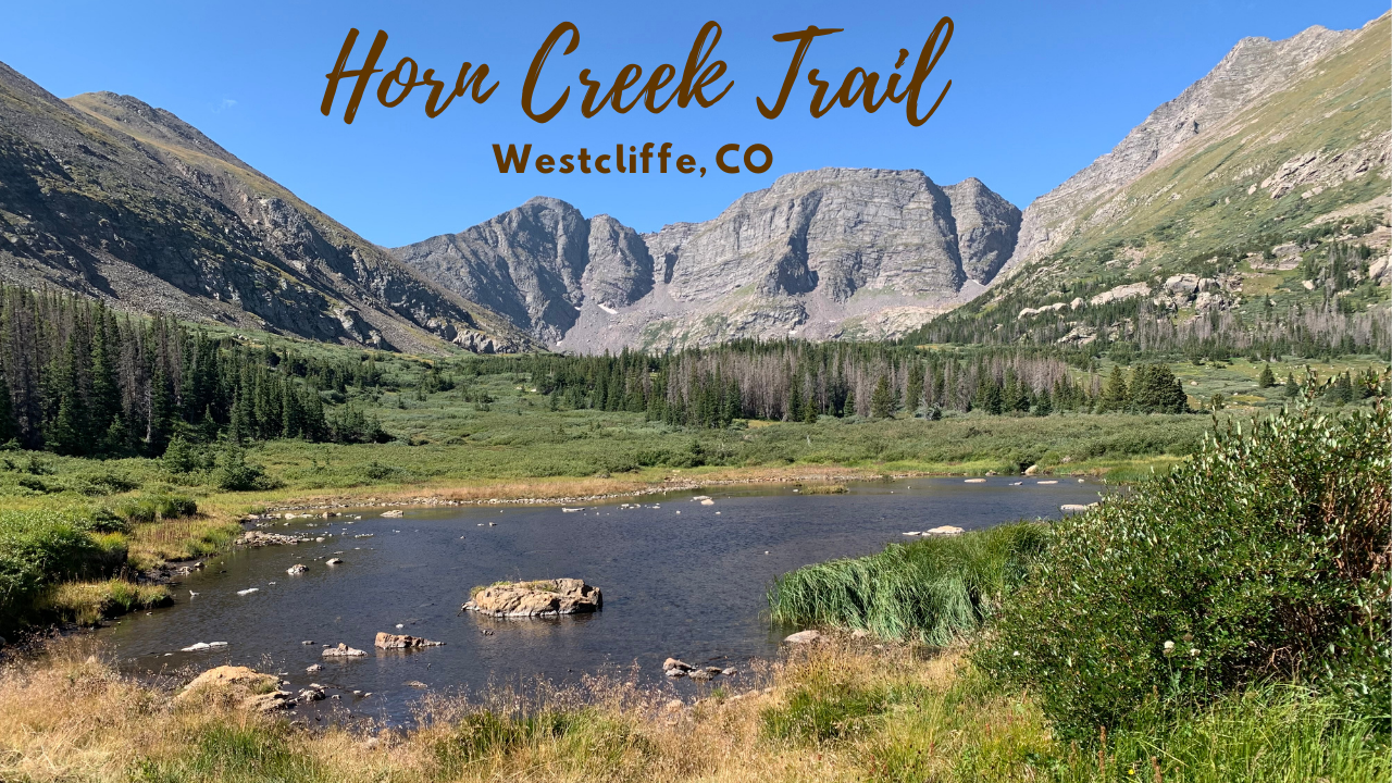
Total Mileage/Elevation: 12 or a bit under
Trail Difficulty: Intermediate due to steady elevation gain and round trip length.
Location: southwest of Westcliffe, CO
This Trail is Good for: Hiking, trail running, horseback riding, fishing, camping
Dispersed Camping Nearby: Camping at the parking lot area, 14 day limit
Forest Service Campground Nearby: there are forest service campgrounds nearby
Pets: yes, on leash
Duration of Hike: 6 hours
Possible Loops: a loop would be difficult but possible with adjacent valleys.
Time of Year I Hiked the Trail: June-October, snow will be present earlier or later
Time to Nearest Town: Westcliffe is within 15 minutes of the trailhead.
Condition of Approach Roads: Well maintained gravel roads and small paved roads
Directions to the Trailhead
Go south from Westcliffe on Hwy 69 a few miles to Schoolfield Rd or 140 Rd. Follow it west to the trail head parking area for Horn Creek Trail and the Rainbow Trail.
Trail Description
Reaching the Horn Creek Trail
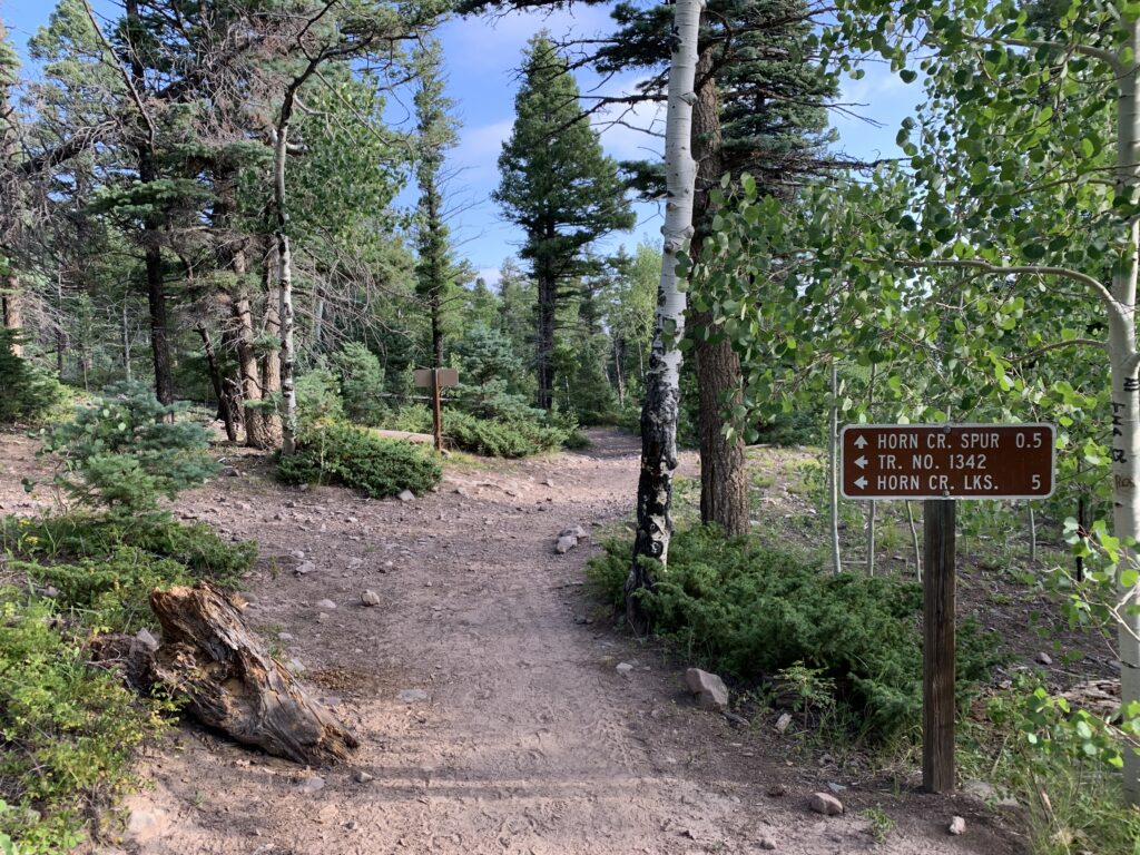
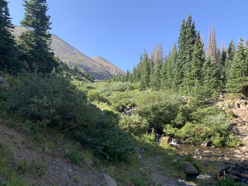
The Horn Creek trail starts off at a parking area along the rainbow trail. To access the Horn Creek trail you need to hike south along the Rainbow trail about a mile to the intersection with the Horn Creek Trail.
The Rainbow Trail runs for approximately 100 miles along the east side of the Sangre De Cristo mountains from south of Salida to south of Westcliffe. It is a relatively low elevation trail and offers continuous access to the foot of the mountains along the Westcliffe valley. It is a multiuse trail allowing 4 wheelers, horses, as well as foot access.
Horn Creek Trail
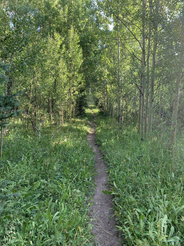
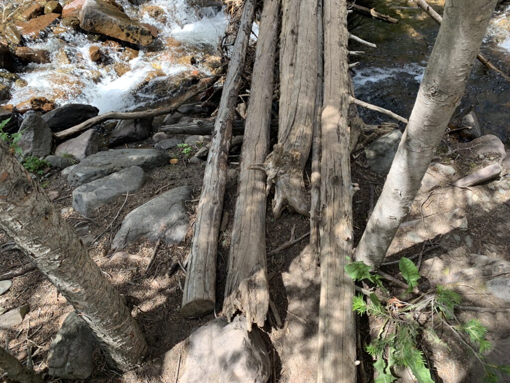
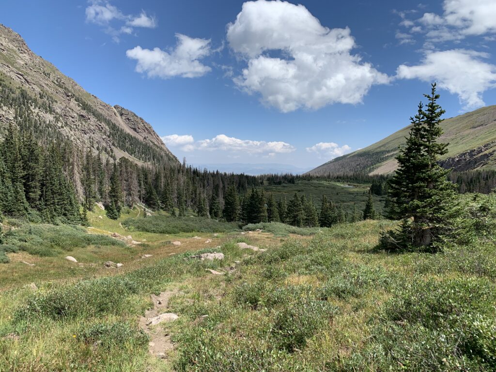
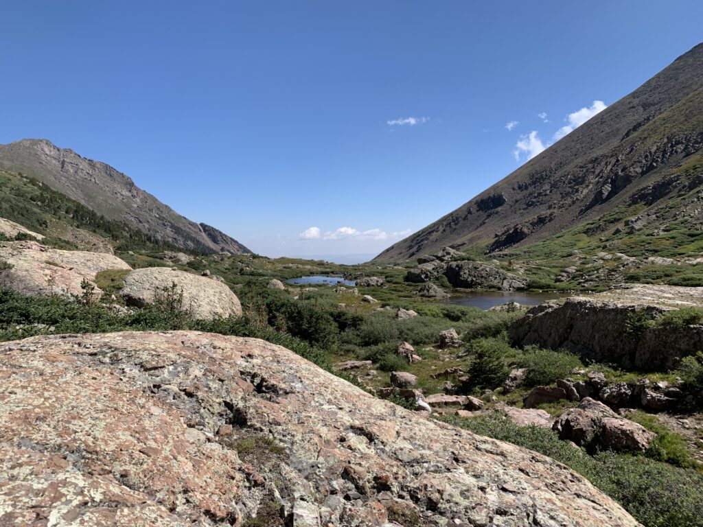
The Horn Creek Trail takes off from the Rainbow trail heading west and will be uphill pretty much the whole way. There’s not much other option in these mountains. The trail is not terribly difficult, mostly just a steady climb for about 5 miles. The trail initially runs mostly on the northern side of the valley that leads up to the Horn Lakes. Below is the creek that drains from the lakes and surrounding mountain cirques. After a couple of miles past the intersection you will have gained enough elevation to cross the creek and walk on the other side of it for a time while you gain tree line.
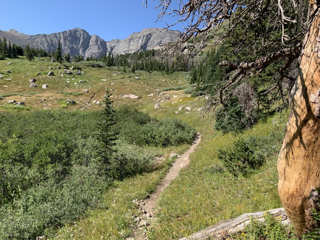
Right around tree line, which is about 4.3 miles into your hike or about 3.3 miles up the Horn Creek Trail, you cross the creek again to continue on up the valley on the north side of the drainage again. At this point you are mostly above tree line with clusters here and there. The views up the valley are very beautiful.
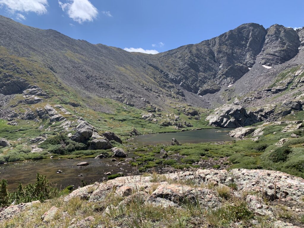
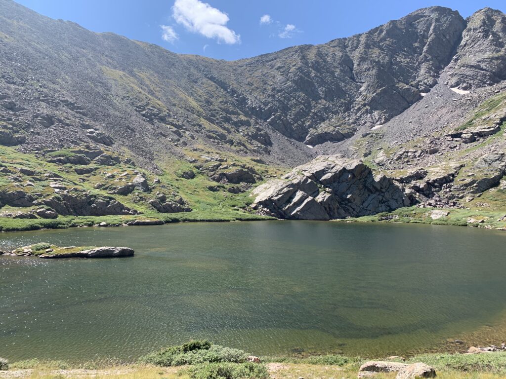
You may think you are almost there, but it is another mile and a half up to the larger lake at the end of the valley. The trail follows the north side of the valley floor and begins winding across scree fields and through brush that has grown up. You eventually get close enough to see the lakes with the farthest one being the largest and a couple of smaller ones below. There are some rocks and open areas to sit on around both lakes. The elevation here is around 11,800 feet. My mileage showed about 6 miles by the time I reached the lakes from the parking area.
There is a sign asking not to camp within 300 feet of the lakes which would put you camping back down the valley a bit below most of the brush for the most part. There may be a few campsites outside of 300 feet from the lakes in this area, but not a whole lot.
The area is absolutely beautiful. The mountains are stark, massive, and stunning. They dwarf the valley making it seem like you’re in a mountain castle. The lakes are crystal clear and there can be good fishing.
When you look down (east) the valley toward the Westcliffe area the valley seems to be hanging in the air and the mountains just drop off below the lakes. This valley is one of those in the Sangre’s that gives you the view all the way back to the Westcliffe valley below. This is in part due to the elevation of the lakes being so high, and the upper part of the valley above tree line is mostly straight without a bend to obscure the view. I think it’s really cool you can look so far back down.
For me this trail is an intermediate trail. It’s not super easy but it’s not truly hard either. It’s all up hill but not super steep at any one point. The rewards and views at the top are spectacular. There are no bad creek crossings, although you will cross the main creek twice neither are very hard crossings. You could ride a horse all the way up this trail easily enough, and there’s evidence that people do.
Where to Get Maps for This Hike:
USGS Online Map Store : Horn Peak, CO
Horn Creek Map: https://ngmdb.usgs.gov/topoview/viewer/#11/37.9964/-105.5536
Gaia GPS App.
Forest Service Contact Information
US Forestry Department
1 Hermit Ln, Silver Cliff, CO 81252