Springfield/Campo/Pritchett, CO
Location Information
Location: Southeast Colorado in Baca County. 1 hr south west of Springfield.
Length of Trail: Trail is approx 1 mile long with very little elevation. There are a few places where you have to climb short amounts of stairs.
This Trail is Good for: Hiking, birding, fishing, swiming
Dispersed Camping Nearby: No, however there is a campground at the parking/picnic area that is free.
Forest Service Campground Nearby: No
Pets: Yes, on leash
Duration of Hike: 1 hour or less
Possible Loops: Yes, if the water can be crossed at the north end of the trail loop.
Time of Year I Hiked the Trail: April, 2021
Directions to the Trailhead:
From Springfield take Highway 160 towards Pritchett. Continue on Hwy 160 towards Kim after you pass through Pritchett. The highway will make a sharp curve south about a mile west of Pritchett, a couple miles south the highway turns back sharply west again to continue on to Kim. On this southern curve there is a power station and a gravel road goes straight south, (County Rd 10) take this gravel road. Take County Rd 10 about 9-10 mi south to County Rd M which runs east and west. CR 10 will T into CR M. Go west at CR M about 6 miles until you come to the Carrizo Campground Sign. It will be on the south side of the road. Follow this road for about 1.5 miles to the picnic area. The trailhead starts here.
From Campo take Hwy 287 north about 3-4 miles to the curve that turns back north. There is a big Viero phone tower here on this curve. Take County Rd M that goes west off of this curve. Go for about 22-23 miles west to the Carrizo Campground Sign on the south side of County Rd M. If you have crossed a green bridge, you’ve gone too far.
Time to Nearest Town: Campo and Pritchett are about 45 min, Springfield is about an hour. Kim is about an hour.
Condition of Approach Roads: Gravel roads are county roads and are well maintained.
Trail Description
Carrizo Canyon is a really cute and pretty little canyon. It offers places to hike, bike, swim, fish (kids mostly), picnic, and overnight camp. It is directly adjacent to the Sikes Ranch State Wildlife Area as well. In addition to the trails around the canyon, there is a two track road to ride or walk along that are a bit longer.
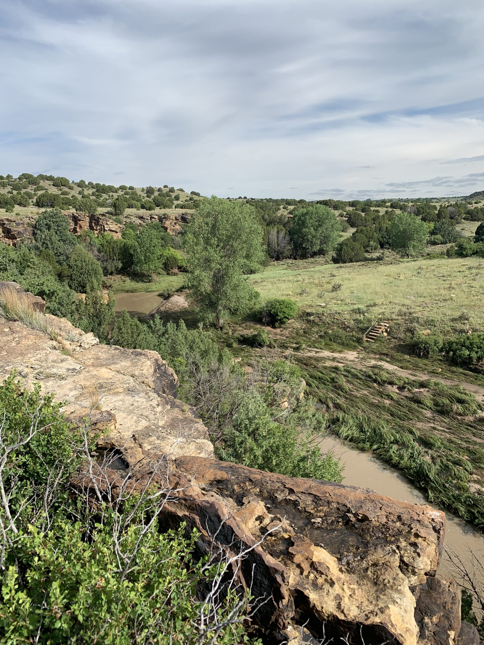
The main hiking trail starts at the Picnic Area along the cement path that leads to an overlook of the canyon. The overlook is a nice place to view the creek below and is handicap accessible. The trail takes off to the left a short way along the cement path and heads down into the canyon just below the parking area.
There is a trail register just below where you descent a few steps that take you below the rim of the little canyon. Then you can hike along the trail to a second set of stairs with a hand rail that will take you to the creek bed. There are usually rocks you can step across at the crossing. The creek is very small here and not very deep.
Directly after the creek crossing you ascend a few rock steps and turn right to go north up the canyon following the creek. There is a small picnic area right at this junction at the top of the steps under some trees.
The trail follows the creek north for about ½ mile. The grade is very gentle if at all.
At the northern end of the trail the creek washes across the trail and usually makes crossing a very wet prospect. However, if the water is low you can cross here and hike back to the picnic area along the eastern rim of the canyon. Usually though, you have to return the way you came. The big pool at the northern end of the trail is where people usually like to swim and has a sandy beach on the eastern side of the creek.
There are petroglyphs in the area if you want to explore and seek them out. Please make it your responsibility to take care of these amazing little treasures if you do.
Where to Get Maps for This Hike:
USGS Online Map Store: Carrizo Mountain Product Number 47794
CalTopo Online Mapping Software- https://caltopo.com/map.html
Forest Service Contact Information
Comanche National Grassland office in La Junta: (719) 384-2181 or in Springfield: (719) 523-6591.