Total Mileage: From Ducket Creek Trailhead– 9 miles round-trip to Rainbow Lake, 14.2 miles round-trip to Cloverdale Mine, 17.5 miles round-trip to Silver Lake
Driving – North Lake Creek Road (RD 198). Same mileage as hiking, the road is accessible by a high clearance 4WD vehicle. This road is rough with some major spots that have large boulders and holes. Not sure I would take my 4WD pick up this road but you probably could with careful driving.
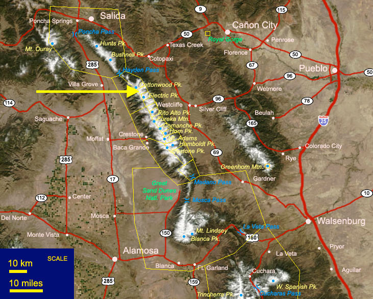
Location: North of Westcliffe 13 miles take RD 198 west past the Lake Creek Campground and continue on 198 (North Lake Creek Road) as far as you like up to the Silver Lake Trail.
This Trail is Good for: Hiking, 4WD driving, fishing, day hiking, backpacking, horseback riding
Dispersed Camping Nearby: Yes, lots along RD 198. Past the Lake Creek Campground and continue on 198. Dispersed camping areas are scattered along the road before Rainbow Lake with some after Rainbow Lake at Silver Lake Trailhead.
Forest Service Campground Nearby: There is a Forest Service Campground along 198 called the Lake Creek Campground with pit toilets, tables etc. This is about 4 miles from Hillside along 198.
Pets: Yes, under control but not necessarily on a leash (unless needed)
Duration of Hike: 5-10 hours round trip to Rainbow or Silver Lakes depending on starting point and how far you go.
No: N.A.
Possible Loops: With Hot Springs Trail and Garner Creek Trail with unmaintained cross over trails. There is a possible loop with taking a cross over trail to Hot Springs trail hiking down the west side of the Sangres and down a road to the Major Creek Trail on the west side then back east up and over to the North Brush Trail to the Peerless Trail and back to Ducket Creek Trailhead (Very Long Loop). Know that crossing over the crest from Silver Lake is done on an unmaintained trail to the Hot Springs Trail. This will require some navigational skills.
Eagle Peak: Rd 198 past Rainbow Lake to gain the ridge is also a way to access and climb Eagle Peak.
Time of Year I Hiked the Trail: We hiked in mid June (June 11) on a low snow year and we saw no snow at all. Silver Lake is at 11,950 ft. So plan accordingly.
Directions to the Trailhead
Take Hwy 69 to Hillside, directly on the south side of town is RD 198. There are signs there for forest access as well. Take this road approx. 4 miles W. At an intersection you can go right to the Lake Creek Campground on 198 or left to RD 337. Stay on Rd 198 and either camp at Lake Creek Campground or drive in to a dispersed camp area along 198. This requires careful driving and a high clearance 4WD vehicle.
Time to Nearest Town: 10-20 minutes from the Lake Creek Campground. Hillside, CO is 4 miles from the Ducket Creek Trailhead. Westcliffe is 13 miles south of Hillside. Texas Creek is 13 miles north of Hillside, CO on Hwy 50 between Canyon City and Salida.
Condition of Approach Roads: The 4 miles in on 198 is a very well maintained gravel road to the Lake Creek Campground. Past the Lake Creek Campground RD 198 is a very rough and at times steep forest road that requires careful driving skills and 4WD high clearance vehicle.
Trail Description
We camped at a dispersed campsite .1mi from the Ducket Creek Trailhead on the Rainbow Trail. I was able to get my large pickup camper into this location just fine. Horse trailers are pulled up here frequently. There were fire rings, but we were under a fire ban when we visited so used stoves in our campers.
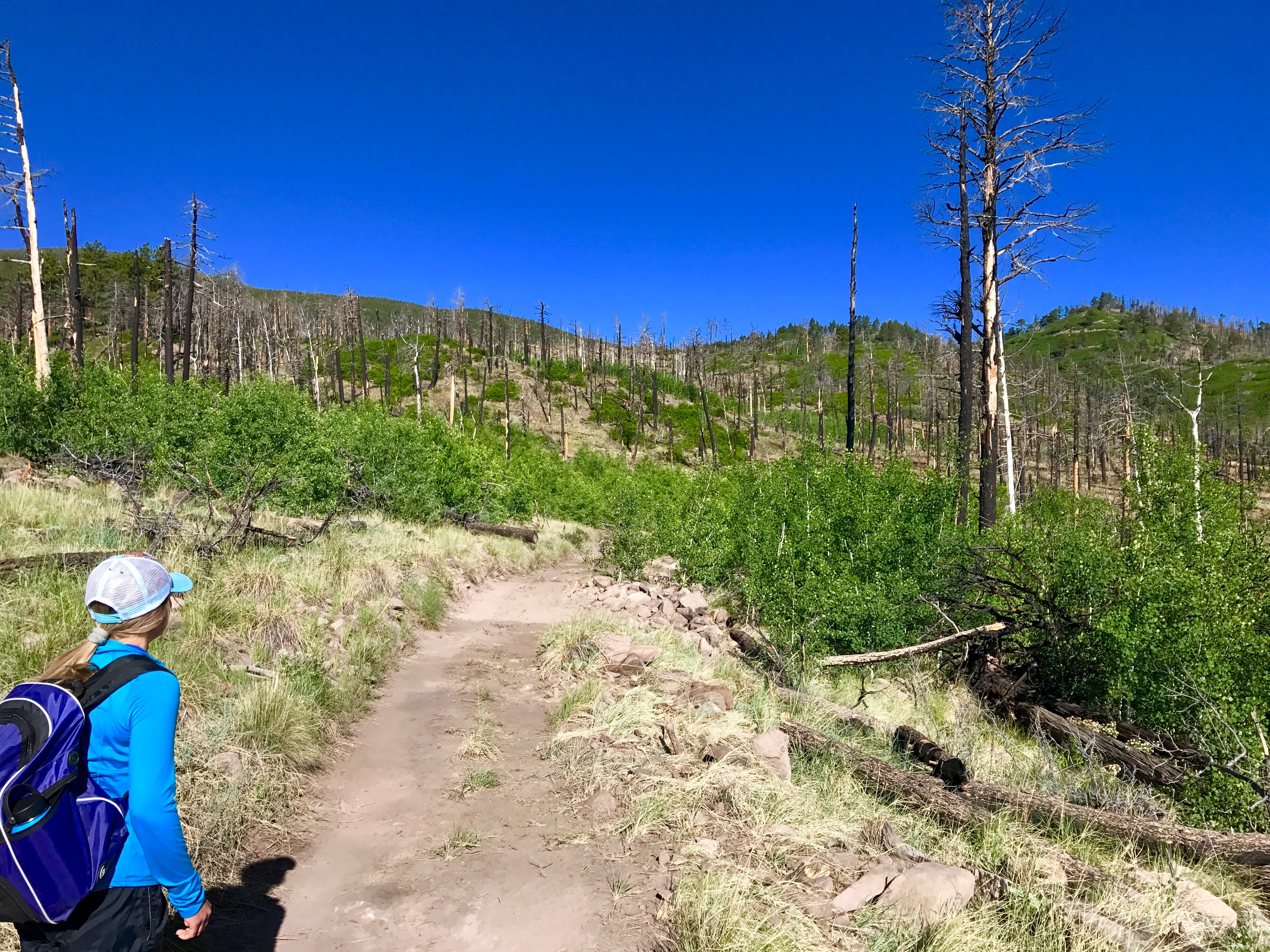
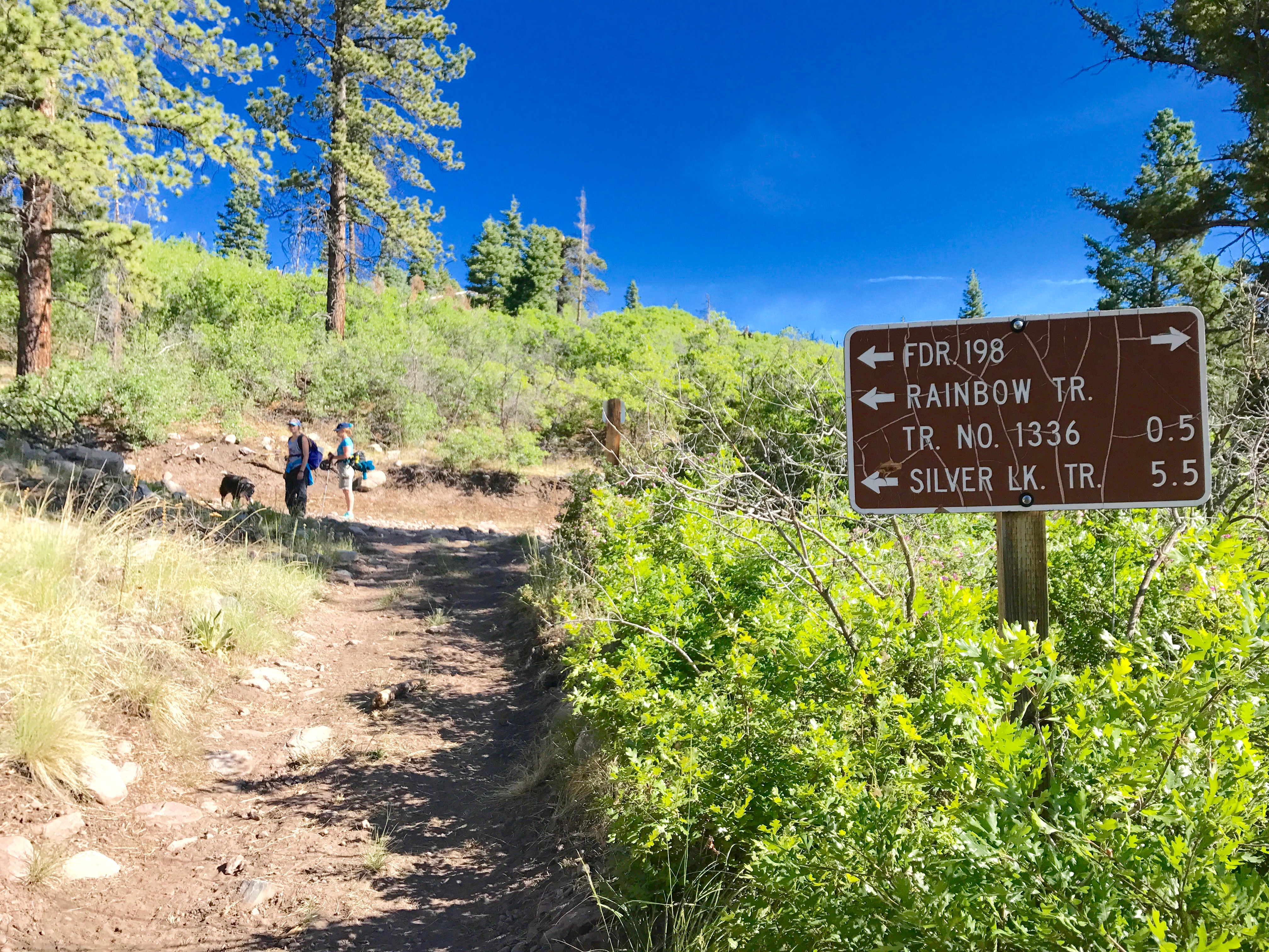
We started at the Ducket Creek Trailhead and headed north along the trail to the intersection with RD 198. This was approx. .9 miles from the Ducket Creek Trailhead. We followed RD 198 for .5 miles before the Rainbow Trail takes off again to the north. We stayed on RD 198 and followed it up as it steadily ascended to Rainbow Lake.
RD 198 continues through a burn area for over a mile. This makes for great views from the road across the valley below. It can also make it kind of hot at times, and the road is a stead up hill walk with little to no flat walking.
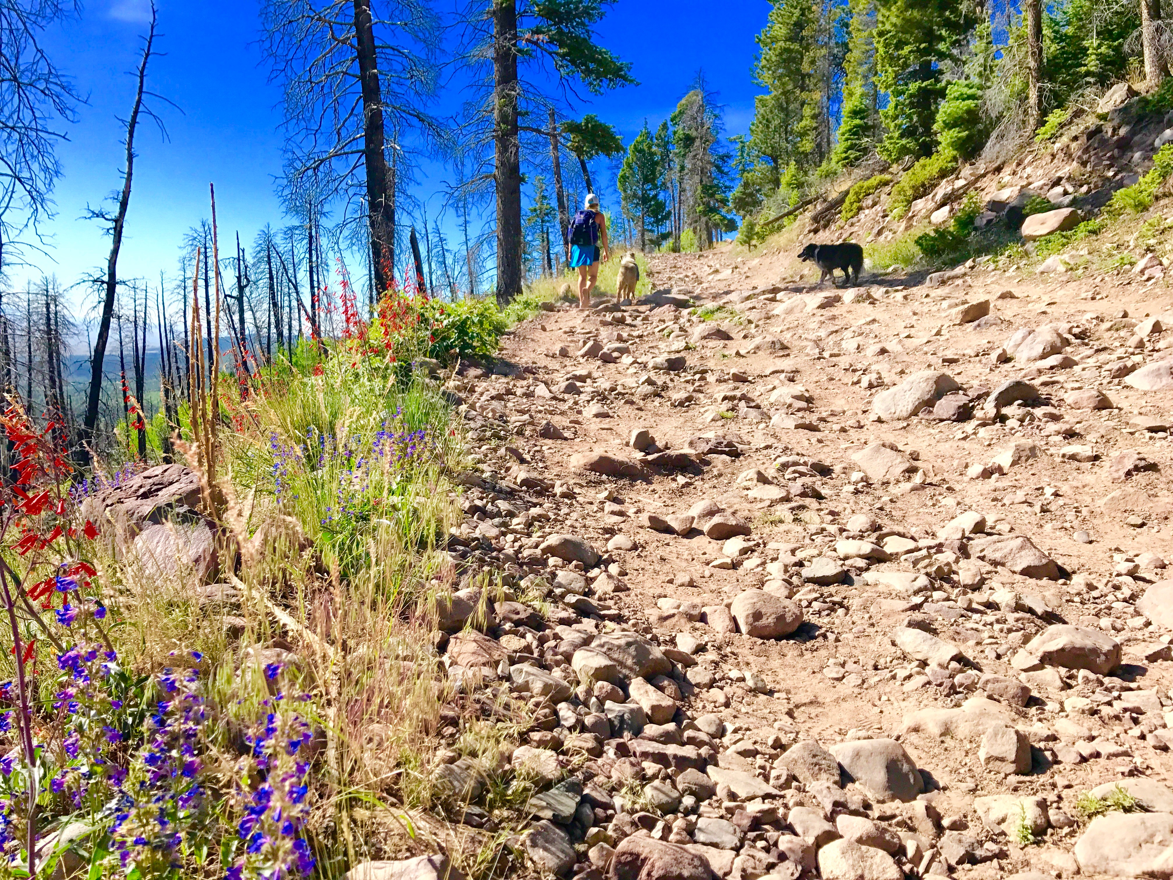
There is dispersed camping areas scattered along the road – marked by FS posts at several places along the road. A very large camp area was .75 miles past the intersection where the rainbow trail continues north from Rd 198. There were camp areas before and after this area. But this area was large enough for a very large group to gather.
Rainbow Lake
 Rainbow Lake is 4.5 miles from the Ducket Creek Trailhead at 10,300 feet. Ducket Creek Trail head is at 8,300 -8,400 feet. So you will go up approx. 400-500 feet per mile. We make the hike in approx. 2 hours with a short break, but expect to take 2-3 hours to make this hike.
The Lake is off the road a hundred yards or so with a large space around it and a wonderful view of Eagle Peak to the west and the ridge leading up to it. There is a dispersed campsite along the road right next to the lake. If you wanted to climb Eagle Peak, you could gain the ridge from Rainbow Lake and walk it to Eagle Peak (13,205ft).
Cloverdale Mine
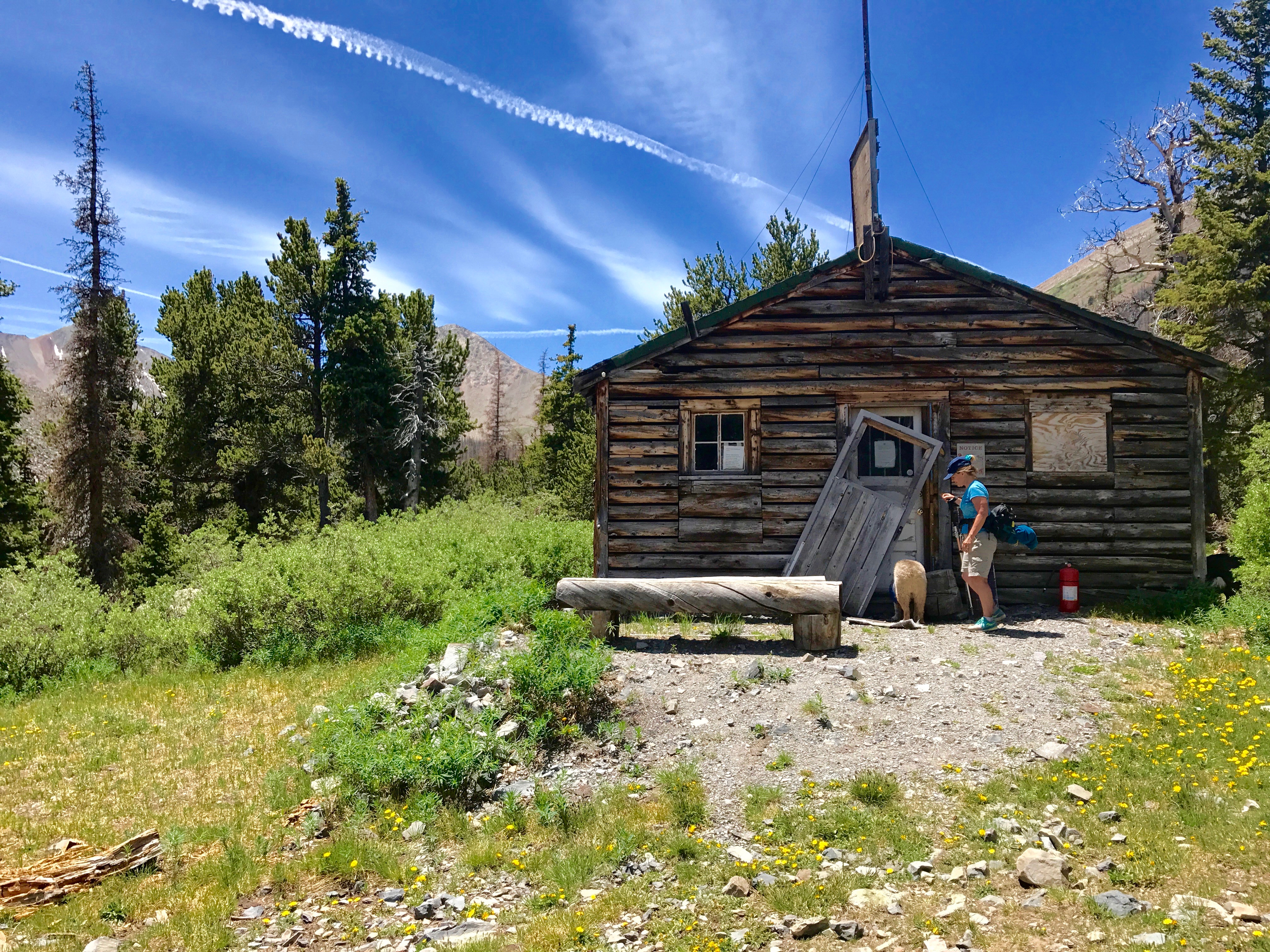
The next major landmark along RD 198 is the Cloverdale Mine. Continue from Rainbow Lake along RD 198 and continue to ascend. At Mile 5.82 from Ducket Creek Trailhead we came to the first Mine cabin and some ruins in the area with a lodge pole corral at 10,731. Past this cabin at Mile 7.1 is the rest of the Cloverdale Mine camp at 11,230ft. It was a surprise to see so many of the buildings still in tact and standing. You walk right through the middle of the mining camp while the mine is on the north flank of Eagle Peak and you can look across to see it. You can walk over there as well along a trail it seems, but we didn’t have time to explore that.
The mine camp is a really interesting place and worth the hike/drive to see it.
Read more about Cloverdale Mine HERE
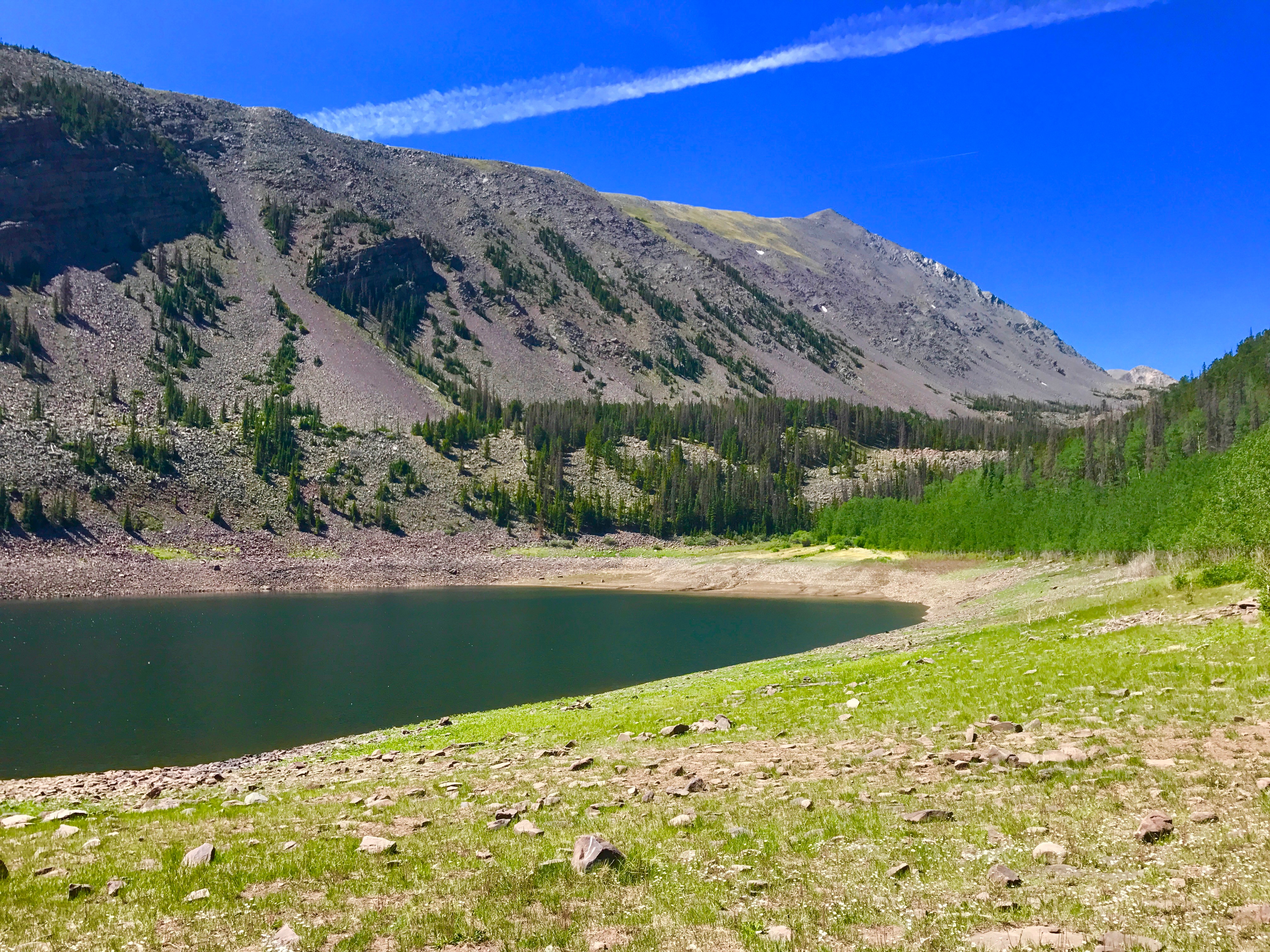
Silver Lake
The furthest destination along RD 198 is the Silver Lake Trailhead. The road winds another 1.8 miles past the Cloverdale mine to the Silver Lake Trailhead. There is a camping area or two at the trailhead. We were wondering if we would ever find the elusive trail! Once we did find the trailhead and sign it said the lake was only another .5 miles. This hike had taken longer than we had anticipated and so we were short on time but decided we had to see the lake since it was only .5 mile further.
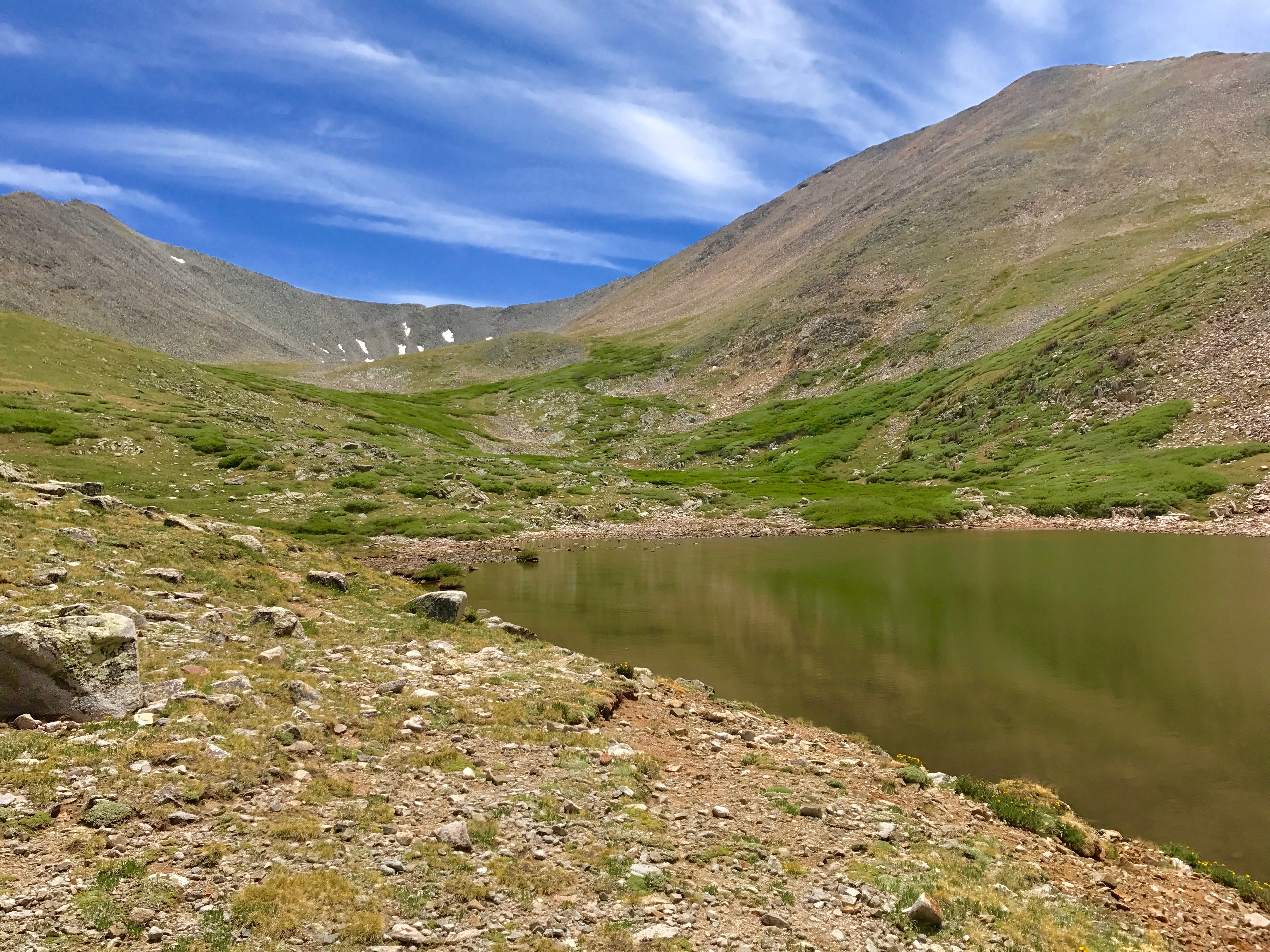
The lake is .5 miles and 400 feet pretty much straight up, especially the last quarter mile of the trail. The trail is not very well used, but you can pick it out as it winds through the forest. It meets up with an old road for the last part of the climb. The lake sits above tree line at 11,950ft, 8.8 miles, and 3,500 ft. above the Ducket Creek Trailhead. There are fantastic views of the surrounding mountains and back down to the valley way below you. There would be campsites at the trailhead, in the trees up to the lake or around the lake. The creek runs from the lake, crosses the trail near tree line and past the trailhead for water. Camping at the lake would provide significant exposure to wind and storms.
We enjoyed the lake for a few minutes and headed back down the mountain, as we had quite a hike to get back to the cars. Don’t underestimate the hike down, as it is rocky, long, continuous, and at times steep and will be hard on your knees and feet. I recommend you take hiking poles.