Cuchara, CO
Total Mileage/Elevation: We hiked 4.3 Miles according to Runkeeper’s GPS. The hike can be between 5-6 miles long if you do the trail end to end. We did an out and back from Hill Rd to a little before where you begin to descend again. Our total elevation gained was right at 1000 ft.
Location: Just on the edge of Cuchara, CO; Hill Rd.
This Trail is Good for: Hiking, trail running
Dispersed Camping Nearby: Not right at this trailhead. You would need to go a few miles farther south on Hwy 12 to the FS road to Bear and Blue Lakes for dispersed camping.
Forest Service Campground Nearby: Blue and Bear Lakes 7-8 miles away.
Pets: Yes, under control or on a leash. This trail is easy to access so, you might meet quite a bit of traffic at times as it is nearly in town.
Duration of Hike: We hiked a little over 4 miles, possibly farther as my GPS was not turned on the whole time I think. We were hiking for about 4 hours, but took a long lunch break at an overlook.
Possible Loops: You could make a loop if you hiked back along the highway to where you parked your car or park you car at either end of the trail to pick yourself up.
Time of Year I Hiked the Trail: I hiked this trail on June 29. I don’t recommend hiking it in the heat of the day. Much of the lower part of this trail is kind of exposed and surrounded in oak brush making it hot. We did an out and back from Hill Rd trailhead. The forested part is ok. Hike it in the morning or evening during the summer.
Directions to the Trailhead
From La Veta take Hwy 12 toward Cuchara. Turn on the road that goes past the old log church and community center with tennis courts. Follow this road straight about .5-.75 mile to the trailhead right on Hill Rd. There is a small amount of parking off to the side of Hill Rd at the Trailhead. There is a sign and a stair case up off the road to the trail.
Time to Nearest Town: About 20 minutes from La Veta, Trail starts on the edge of Cuchara.
Condition of Approach Roads: Hwy 12 is a Colorado Scenic Route and is a good highway. It can be slow with lots of curves.
Trail Description
The trail is supposed to access a Dike, and it does get close to a Dike, but you would need to bushwack up to the dike. We did not do this as the kids on our hike were way over it at that point. The trail starts with switchbacks up a hillside in the oak brush. Over the first mile it gains about 800 feet. This part of the trail can be a bit exposed and on hot sunny days can be pretty warm going up or down.
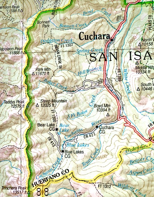
We reached the forest toward the end of the first mile and not long after that found a couple of rocks and an overlook at about 1.5-2 miles in. We had lunch here. The view is pretty as you are looking mostly south toward Trinchera Peak. You can see the Hwy 12 below you in the valley.
We continued along the trail for about another mile trying to find the little connector trail that I had hoped would take us up to the Dike. It may exist, but we didn’t find it and by that time decided it was the better idea to turn around and get ice cream. We did not go all the way to where the trail begins to descend, but we were close according to AllTrails GPS and maps. So, kind of disappointing. You do hike along the dike, but several hundred feet away from it, and it is hard to see through the trees.
The hike back down was hot and seemed longer than the hike coming up since you can see the town of Cuchara right below you for quite awhile giving you the false impression you are almost there. I recommend hiking this trail in the morning or evening and not during the heat of the day in the summer for this reason. There were some good views from the trail. There is not water on this trail so pack plenty for warm weather. We ran out.

Our lunch break view 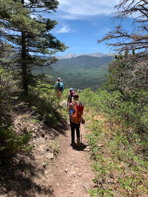
View of the Cuchara valley to the south 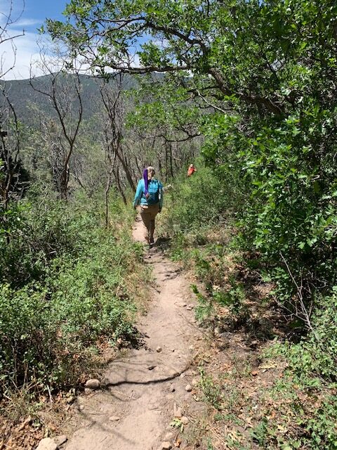
Hiking down the bottom part of the trail 
Dike Trail ascends through oak brush and intermittent pines.
Where to Get Maps for This Hike:
CalTopo Online Mapping Software- https://caltopo.com/map.html
Pike and San Isabel National Forest Link
https://www.fs.usda.gov/recarea/psicc/recreation/hiking/recarea/?recid=12730&actid=50
Forest Service Contact Information
Pike & San Isabel National Forests, Cimarron & Comanche National Grasslands
2840 Kachina Drive
Pueblo, CO 81008
(719) 553-1400
TTY: (719) 553-1404
M-F, 7:30am–4:30pm