Total Mileage/Elevation: About 2.5 miles to Dodgeton Creek from the Spring Creek Trailhead. The Road continues up farther past the first major crossing following the valley to the intersection with the Indian Creek Trail. We ended up climbing around 1400ft on our hike.
Location: The Spring Creek Trailhead is what we used to access this hike. It is located just off of Hwy 12 on the south end of Cuchara on the west side of the road. There are signs pointing out the trailhead off of the highway. There is a $7 fee for parking or day use/day. There are picnic tables here and a pit toilet as well.

This Trail is Good for: Hiking, bird watching, mt. biking, horseback riding, backpacking, cross country skiing, snow shoe., 4 Wheeler use
Dispersed Camping Nearby: Not right at this trailhead. You would need to go a few miles farther south on Hwy 12 to the FS road to Bear and Blue Lakes for dispersed camping.
Forest Service Campground Nearby: Blue and Bear Lakes 7-8 miles away.
Pets: Yes, under control or on a leash. This trail is easy to access so, you might meet quite a bit of traffic at times.
Duration of Hike: We hiked in about 3 miles. We did this hike with two 8 year olds and a 7 mo old infant. The creek where we had lunch was about 2.5 miles in, but it was up the whole way!
Possible Loops: Yes! There are possible loops with the Baker Trail and the Indian Trail if you loop them together with the Dodgeton Creek Trail. It would be approx. 9-10 miles long, maybe a bit longer. The loop would be to hike up Dodgeton Creek to the intersection with the Indian Creek Trailhead – approx. 3 miles or a bit over. Then take the Indian Trail to the south to the Baker Trail which would be approx. 2.5 miles. Then take the Baker trail back to the north west to the Spring Creek/Dodgeton Trail for approx. 3 miles. Then there would be about 1.5 miles back to the trailhead creating a lollypop route for approx. 10 miles long.
Time of Year I Hiked the Trail: I hiked this trail on June 15. The first part of the trail is pretty exposed so it was warm. The second part had more tree cover making it a bit cooler. The bottom part of this trail might make a good snowshoe or cross country ski. Avalanche danger would need to be considered past 2.5 miles in most likely.
Directions to the Trailhead
From La Veta take Hwy 12 toward Cuchara. On the very south end of Cuchara there is a sign for Spring Creek Trail on the west side of the road.
Time to Nearest Town: About 20 minutes from La Veta, pretty much in Cuchara.
Condition of Approach Roads: Hwy 12 is a Colorado Scenic Route and is a good highway. It can be slow with lots of curves.
Trail Description
The Spring Creek trail starts at the parking area and is small 4 wheeler road. You can not drive a full-size vehicle on it, but it is built for 4 wheeler use. We hiked it the day we went. Would be good for horses as well since there is lots of clearance. The road starts off going up. It is not a super steep climb, but a steady moderate climb that continues for about 2 miles- we ended up climbing around 1400 feet on our hike. The views about 1.5 miles in are very pretty looking east towards the Spanish Peaks over the valley below.
Once you cross over the first ridge about 2 miles in the forest gets a bit wetter and you descend to Dodgeton Creek. We stopped here for lunch and to play in the creek. The crossing is pretty shallow and you can make it across dry footed if you are careful. A good place for kids to play as the creek isn’t too deep or fast.
Past the first creek crossing the road continues to ascend at a more moderate incline following the creek and occasionally crossing it. The road soon winds up into some Aspen stands. There is a really great campsite just off to the left of the trail big enough for a small group of people near the second creek crossing. We didn’t go much past here, but I hope to go farther along this trail soon. The valley above this looks to be enticingly beautiful.
Where to Get Maps for This Hike:
Trinchera Peak, CO & Cucharas Pass, CO – http://store.usgs.gov
CalTopo Online Mapping Software- https://caltopo.com/map.html
Pike and San Isabel National Forest Link
https://www.fs.usda.gov/recarea/psicc/recreation/hiking/recarea/?recid=12731&actid=50
Forest Service Contact Information
Pike & San Isabel National Forests, Cimarron & Comanche National Grasslands
2840 Kachina Drive
Pueblo, CO 81008
(719) 553-1400
TTY: (719) 553-1404
M-F, 7:30am–4:30pm

First Part of the Trail 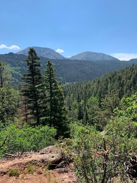
View up the trail a ways 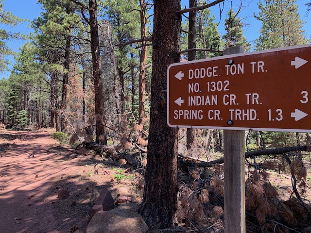
Intersection with Baker Trail 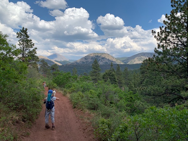
Looking east to Spanish Peaks 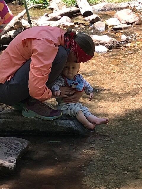
Dodgeton Creek 
Past first crossing of Dodgeton Creek