Cuchara, CO
Total Mileage/Elevation: We hiked 4.7 miles to the junction with Baker Trail from the Bear Lake Campground trailhead of the Indian Trail. We did a short .75 round trip side trail to a view about one mile in on the trail. So total trail miles were probably closer to 4miles along the Indian Trail round trip. Our total elevation was about 950 ft on the Indian Trail and about 200 feet up to the view.
Location: The trailhead takes off from the Bear Lake Campground south of Cuchara. Day use fees apply and it is $7.
This Trail is Good for: Hiking, trail running, ATV, horseback riding, Cross country skiing, birding, backpacking
Dispersed Camping Nearby: Not right at this trailhead. There is dispersed camping close by on FS 413 just outside of the Bear Lake Campground. The road looks to be fairly steep so a good 4WD vehicle with good clearance would be needed.
Forest Service Campground Nearby: Blue Lake campground and Bear Lake Campground
Pets: Yes, under control or on a leash. This trail is easy to access so, you might meet quite a bit of traffic in the first few miles. The trailhead takes off right in the Bear Lake Campground, so be respectful of other campers as you get ready to go.
Duration of Hike: We hiked about 4 miles round trip, and it took us about 2.5 hours. The trail gains elevation right away – so there was quite a bit of up in our 4 mile hike out and back.
Possible Loops: Yes. You could do a look connecting the Baker Trail, Dodgeton/Spring Creek Trail, and the Indian Trail. Total miles would be approx. 10 for the whole loop to end up back and the Bear Creek Campground.
Time of Year I Hiked the Trail: I hiked this trail on July 10. Much of it was forested so that was very nice for a warm summer day. There were a couple of small stream crossings along the 2 miles we hiked in. Great for dogs and kids J
Directions to the Trailhead
From La Veta take Hwy 12 to Cuchara and then past Cuchara about 4 miles to the Bear and Blue Lakes turn, CR 422. The lakes are about 4 miles up this road. You will come to Blue Lake Campground and lake first and then a mile or so later Bear Lake Campground and Lake. You have to enter the campground and drive to the back of the loop to access the trailhead. There is a small parking area there and a pit toilet. Day use fees apply and it is $7.
Time to Nearest Town: About 20 minutes to Cuchara.
Condition of Approach Roads: Hwy 12 is a Colorado Scenic Route and is a good highway. It can be slow with lots of curves. CR 422 is wide and maintained but is very rough with washboard. We took it pretty slow. You can bring an RV or camper up this road.
Trail Description
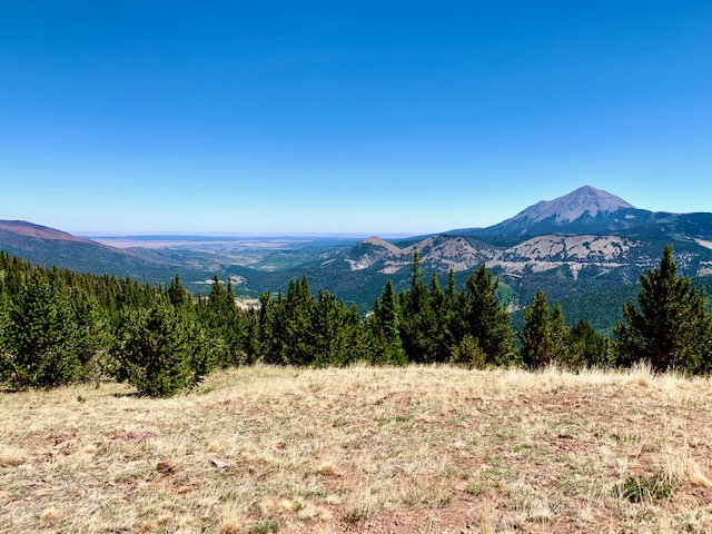
The trail is fairly wide and well maintained. It can be used by ATV’s from the looks of it. The trail heads steadily up from the campground to gain a ridge about a mile in. You begin coming out into a meadow about .75 miles. There is a small stream that you cross about .5-.6 miles in. There is a great view up on top of the ridge to the east. Not far after you have passed the old fence line and fence posts there is a side trail that goes right. It climbs a couple of hundred feet up to a ridge and there are views of the valley below and the West Spanish peak. We spent about 20 minutes up there enjoying the view and having a snack in the shade of a bristlecone pine. Worth the climb!
After our little break we continued on the trail and it quickly begins to head down the back side of the ridge. The trail was very enjoyable as it wandered through the forest. There is a small creek that crosses the trail about 1.8 miles in. We ate lunch here and enjoyed the water a bit as we returned from the junction with the Baker Trail. Shortly before the Baker Trail junction we saw a small group of wild turkeys and their babies using the trail as well. That was a fun sighting.
The Baker Trail is well marked with two signs one along the Indian Trail and one at the top of the Baker trail. The Baker trail takes off to the north and east and the Indian Trail continues to the north. I look forward to hiking the Baker trail in the near future and possibly doing the loop hike.
The climb from our lunch spot back to the ridge was steady and a little steep. My legs were tired from a bike ride the day before and so I went slowly.
It was just a great day to be out and we really enjoyed this hike. The hike has great views, water, a well maintained and clearly marked trail.
View from Side Trail at the top of the ridge 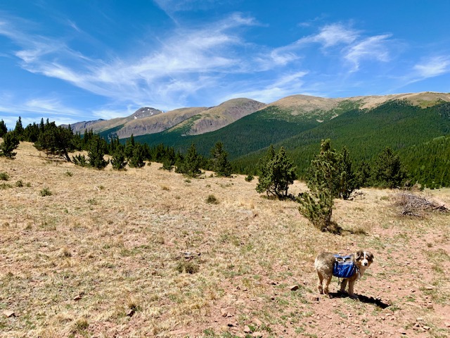
View from the Indian Trail at the top of the first climb looking south 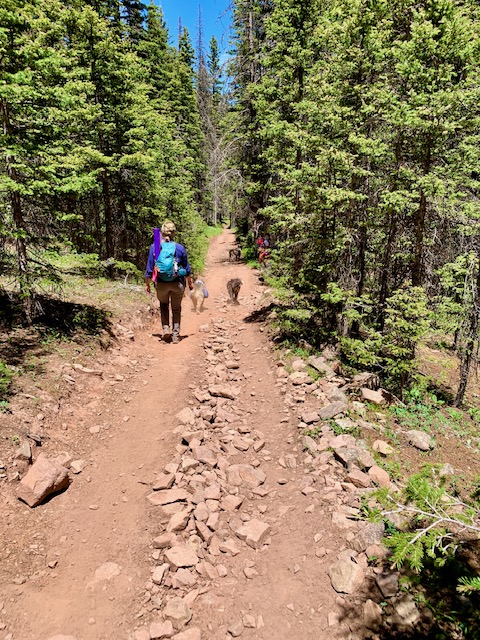
The Indian Trail is a wide trail for ATV and hiking use 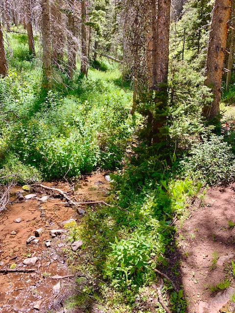
A small creek great for a break 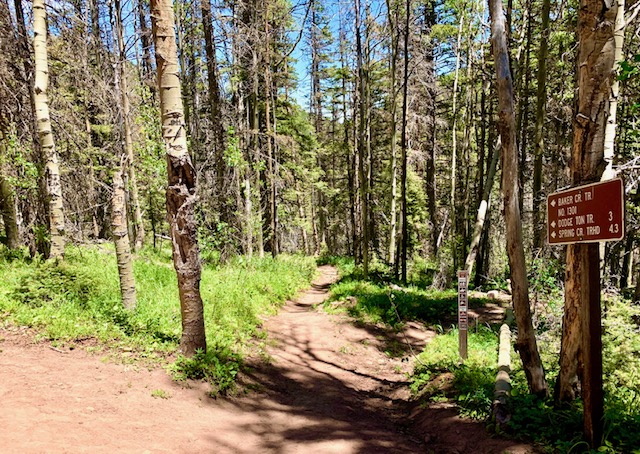
Trail intersection with Baker Trail 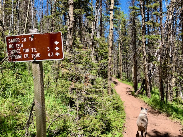
Sign for Baker Trail along the Indian Trail
Where to Get Maps for This Hike:
Trinchera Peak, CO & Cucharas Pass, CO – http://store.usgs.gov
CalTopo Online Mapping Software- https://caltopo.com/map.html
Pike and San Isabel National Forest Link
https://www.fs.usda.gov/recarea/psicc/recreation/hiking/recarea/?recid=12748&actid=50
Forest Service Contact Information
Pike & San Isabel National Forests, Cimarron & Comanche National Grasslands
2840 Kachina Drive
Pueblo, CO 81008
(719) 553-1400
TTY: (719) 553-1404
M-F, 7:30am–4:30pm