Spring Creek-Dodgeton #1302-Indian Trail #1300-Baker #1301 Loop Hike
Cuchara, CO
Total Mileage/Elevation: Cal Topo says this hike is more along the lines of 9-10 miles, but when I tracked it through the AllTrails App the day we hiked it, the total mileage came out to be 12.4. I am pretty new to All Trails and am not sure how accurate it really is. So the hike is somewhere between about 10 miles and 12.5 miles long. The total elevation gain recorded by All Trails was 2323 ft. This is pretty accurate from looking at the map. You start at around 8,200ft and gain elevation steadily for the first 6 miles to a high ridge at around 10,620 ft. Because the elevation gain is spread over 6 miles the hike is not that steep. A moderate climb, but a steady climb.
Location: You can start this hike from a couple of locations. You could start from Bear Lake Campground and hike over to the Baker Trail or Dodgeton Trails.
We chose to do the hike from the Spring Creek Trailhead at the edge of Cuchara just off of Hwy 12. We went counter clockwise up the Dodgeton Trail and down the Baker Trail.
This Trail is Good for: Hiking, trail running, ATV, horseback riding, birding, short backpacking trip.
Dispersed Camping Nearby: There is dispersed camping close by on FS 413 just outside of the Bear Lake Campground. The road looks to be fairly steep so a good 4WD vehicle with good clearance would be needed. There is no dispersed camping at the Spring Creek Trailhead. You would need to camp up near Bear Lake, in La Veta at an RV park, or possibly up the road to Cordova Pass.
Forest Service Campground Nearby: Blue Lake campground and Bear Lake Campground. Be aware that these campground are reserved in advance and fill up quickly months in advance. There are 4-6 first come first serve sites at each campground, but these are very hard to come by during summer. Don’t count on it.
Pets: Yes, under control or on a leash near public areas. This trail is easy to access so, you might meet quite a bit of traffic in the first few miles. The trailhead takes off right in the Bear Lake Campground, so be respectful of other campers as you get ready to go.
Duration of Hike: The hike took us about 6 and a half hours including breaks for snacks and a lunch break of about 30 minutes.
Possible Loops: We did the loop hike by connecting the Spring Creek Trail to the Dodgeton Trail to the Indian Trail to Baker Trail and back to Spring Creek Trail. You could go down the Indian trail farther to the north, but it is closed at some point due to damage to the trail from the Spring Creek Fire. To the south the Indian trail ends at the Bear Lake Campground. You could connect the Indian Trail the North Fork of the Purgatorie Trail by walking the FS roads that lead toward Trinchera Peak.
Time of Year I Hiked the Trail: I hiked this trail on July 17. We started fairly early in the morning around 7:30am. We finished around 1:30-2 pm.
Directions to the Trailhead
From La Veta take Hwy 12 to Cuchara. The Spring Creek trail is at the south end of Cuchara just off of Hwy 12. There is a sign on the highway showing the turn off. There is a small parking area there and a pit toilet as well as a few picnic tables. Day use fees apply and it is $7.
Time to Nearest Town: About 20 minutes to La Veta, CO.
Condition of Approach Roads: Hwy 12 is a Colorado Scenic Route and is a good highway. It can be slow with lots of curves.
Trail Description
This was a loop/lollipop hike connecting several trails. We started at the Spring Creek Trailhead and followed that to the Dodgeton Trail, then followed that to the Shortcut Trail #1300A and then connected up with the Indian Trail. The Indian Trail south bound took us to the intersection with the Baker Trail which looped us back around to the north and connected us back up with the Spring Creek Trail. We did this loop counter clockwise thinking it might be a bit less steep than hiking up the Baker Trail. I might have been, but really the Baker Trail was only steep for a short part. Otherwise there was steady elevation gain in either direction you hike it.
Our hike started at the Spring Creek Trailhead near Cuchara. The trail from here is a multi-use trail that you can tell is used by 4 Wheelers and similar off road vehicles. Full-size vehicles cannot access this trail. So the trail is wide and relatively moderately graded. There are some good views of the Cuchara Valley from this trail about 2/3-3/4 mile in. There is no water on this section of the hike. In about a mile you meet up with the Dodgeton trail and continue on.
The Dodgeton trail, about 1.8 miles long in total, continues the climb as a multiuse trail over a small ridge and down to your first crossing of Dodgeton Creek at around 2 miles in. The trail crosses the creek a couple more times in the next mile, but all crossings can be made easily with out getting your feet wet. The trail begins to ascend more steeply after this last creek crossing to meet up with the Indian Trail. There is a small stream that runs along this part of the trail for awhile and it was a pleasant hike up. I didn’t realize it until we hiked it but there is a “Shortcut Trail #1300A” that leads from the Dodgeton Trail to the Indian Trail Proper. This connector trail is about 1.5 miles long. By the time you get to the Indian Trail Proper you have hiked about 4.3 miles. If you want a little more information on the Dodgeton Trail check out my blog post of our hike on Dodgeton Trail here.
The Indian Trail is a longer trail about 14 miles in total length. In this loop you only hike about 2 miles of it connecting the Dodgeton Trail to the Baker Trail. (If you include the shortcut connector trail the total on Indian Trail is 3.5 miles.) The Indian Trail runs from the north near La Veta all the way to the Bear Lake Campground. The northern end of the Indian Trail and road access to it is currently closed due to trail damage from the Spring Creek Fire. The Indian Trail is a multiuse trail and available for off road vehicles so it is wide and moderately graded. Along this portion of the trail there are many beetle kill trees and whole swaths of the forest are thick with dead trees. The trail is pretty well shaded so it made for nice summer hiking.
The Indian trail continues to climb up to a final elevation at a saddle before Baker Creek of about 10,620. On this saddle is an area that has flat camp spots and a fire ring that has been used in the past. There are some dead trees in the area, so be cautious about where you choose to set up camp if you stay here. However, there are places that you could safely set up. Water for this campsite is a steep .3 mile down the trail to the south at Baker Creek. Baker Creek was a beautiful location along the trail. I really enjoyed this spot on the hike. It was shaded, beautiful, and a great spot for a snack. The creek is one of the larger creeks in the area. The crossing was still pretty easily done with dry feet.
From Baker Creek the trail climbs again from the drainage and contours around the mountain to the Baker Trail junction in about .75 mile. The Indian Trail as it continues on to the south past the Baker Cree Trail actually gains elevation all the way to the ridge about a mile from the Bear Creek Campground trailhead to around 10, 750 feet. See my blog post here on our hike along the Indian Trail from Bear Creek Campground to see the amazing views from the southern end of the Indian Trail. At the Baker Trail junction you have hiked a little over half of the loop at around 6.5 miles. Just a note, the whole back side of this loop was mostly forested hiking with really no views. It was still a great hike.
The Baker Trail descends on single track trail descending to the Baker Creek drainage and meeting back up with Baker Creek in about .5 mile maybe a bit over. The trail is steepest here, but not a lot of switchbacks like the map shows. I was thinking it was going to be much steeper. The trail then follows Baker Creek for about a quarter of a mile before beginning to contour around the mountain and bending back to the north. Most of your elevation along this trail is lost between the Indian Trail and the point at which it leaves the creek. The elevation loss after this is much more gradual. About a half a mile after leaving the creek, you can look across a little valley and see some of the old ski runs and lifts at the Cuchara Ski Area to the south. The trail continues north along the side of the mountain with less tree cover and crosses a small drainage called Hill Branch and meets back up with the Spring Creek trail in an open forested area with Ponderosas. The hike is then back to your car at Spring Creek Trailhead.
Even though we hiked on a Friday in the height of summer, we only saw about 10 people on the whole hike. We saw two for wheelers. We were lucky enough to see some wild turkey, grouse, and several deep on our hike as well.

View from Spring Creek Trail of Spanish Peaks and Cuchara Valley 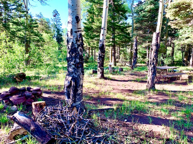
Campground near Dodgeton Creek Trail 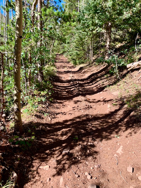
Dodgeton Trail 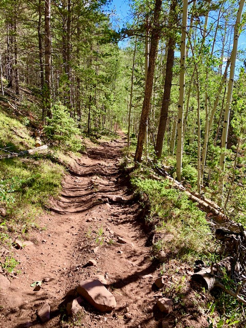
Dodgeton Trail 
Upper Dodgeton Trail 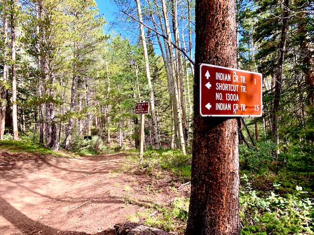
Shortcut Trail Intersection with Dodgeton Trail 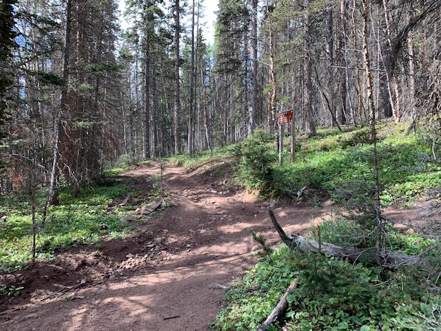
Shortcut Trail #1300A to Indian Trail 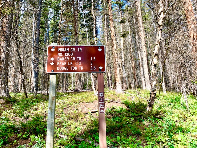
Intersection Indian Trail 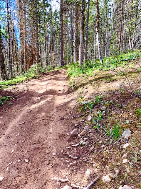
Indian Trail 
Campsite on the Saddle along Indian Trail before north of Baker Creek 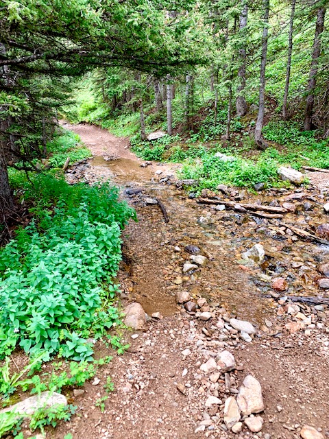
Baker Creek Crossing on the Indian Trail 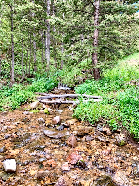
Baker Creek Crossing on the Indian Trail 
View of Spanish Peaks and Cuchara Valley from Baker Creek Trail
Where to Get Maps for This Hike:
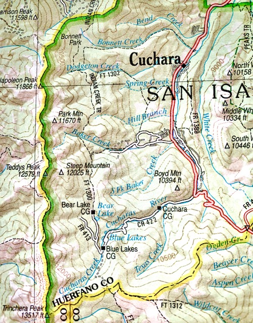
Trinchera Peak, CO & Cucharas Pass, CO – http://store.usgs.gov
CalTopo Online Mapping Software- https://caltopo.com/map.html
Pike and San Isabel National Forest Link
Baker Trail :https://www.fs.usda.gov/recarea/psicc/recreation/hiking/recarea/?recid=12706&actid=50
Dodgeton Trail: https://www.fs.usda.gov/recarea/psicc/recreation/hiking/recarea/?recid=12731&actid=50
Indian Trail: https://www.fs.usda.gov/recarea/psicc/recreation/hiking/recarea/?recid=12748&actid=50
Spring Creek Trailhead: https://www.fs.usda.gov/recarea/psicc/recreation/hiking/recarea/?recid=12794&actid=50
Forest Service Contact Information
Pike & San Isabel National Forests, Cimarron & Comanche National Grasslands
2840 Kachina Drive
Pueblo, CO 81008
(719) 553-1400
TTY: (719) 553-1404
M-F, 7:30am–4:30pm