Total Mileage: My GPS went rain dead. But it is 2.35 mi from the correct Lilly Lake Trail Intersection to the Lake itself. Approx 1.25-1.5 mi from this trail intersection to the trail head parking area for an approx 7.5-7.75 mile round trip. Also approx 1900 feet of elevation gain.
Location: Lilly Lake Trail SW of Red Wing and Gardner, CO
This Trail is Good for: Fly Fishing, Creek Fishing, Hiking, Backpacking, a bit narrow for horses but I saw the evidence of them.
Pets: Yes, under control but not having to be on a leash
Duration of Hike: 4-6 hours, we started at 11:00am and returned to the pickup at 5pm
No: This is in the Sangre De Cristo Wilderness so no chainsaws and no bikes.
Possible Loops: Not really. You could hike farther up the valley before or after hiking up to Lilly Lake. Pretty much an out and back without technical mountaineering equipment and skills.
Time of Year I Hiked the Trail: Sep 23, perfect fall colors!
Directions to the Trailhead
From Walsenburg take Hwy 69 to Gardner, just to the west of Gardner turn south towards Red Wing on CR580. Stay on CR 580 once it turns to gravel and heads toward the Huerfano State Wildlife Area. The road will pass through the Huerfano SWA and back onto private property until it crosses again into the San Isabel National Forest. Drive to the end of the road where there is a trail head parking lot for Lilly Lake Trail.
Time to Nearest Town: From Walsenburg it took us 1:45minutes to reach the trailhead on the way in.
Condition of Approach Roads: The gravel road is long and slow, but in good shape for a Forest Service Road. You can get a car in much of the way. I saw a Honda Accord coming out from near the top of the road! There are clearance issues for cars, but they can go quite a ways up this road past the private property. Slick roads may become an issue for cars. I would recommend a higher clearance vehicle and 4WD as I needed it to get up one of the hills that was muddy when we went in.
Trail Description
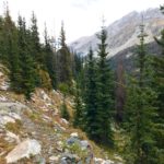
This trail is one of the more beautiful in the state with LOTS of bang for your buck. Since you start out at 10,400 feet you can hike in an amazingly beautiful valley surrounded by huge mountain scenery and it is virtually flat. So if you don’t want to make the climb up to Lilly Lake you still have amazing views and really great creek fishing with lots of good camping options on the valley floor.

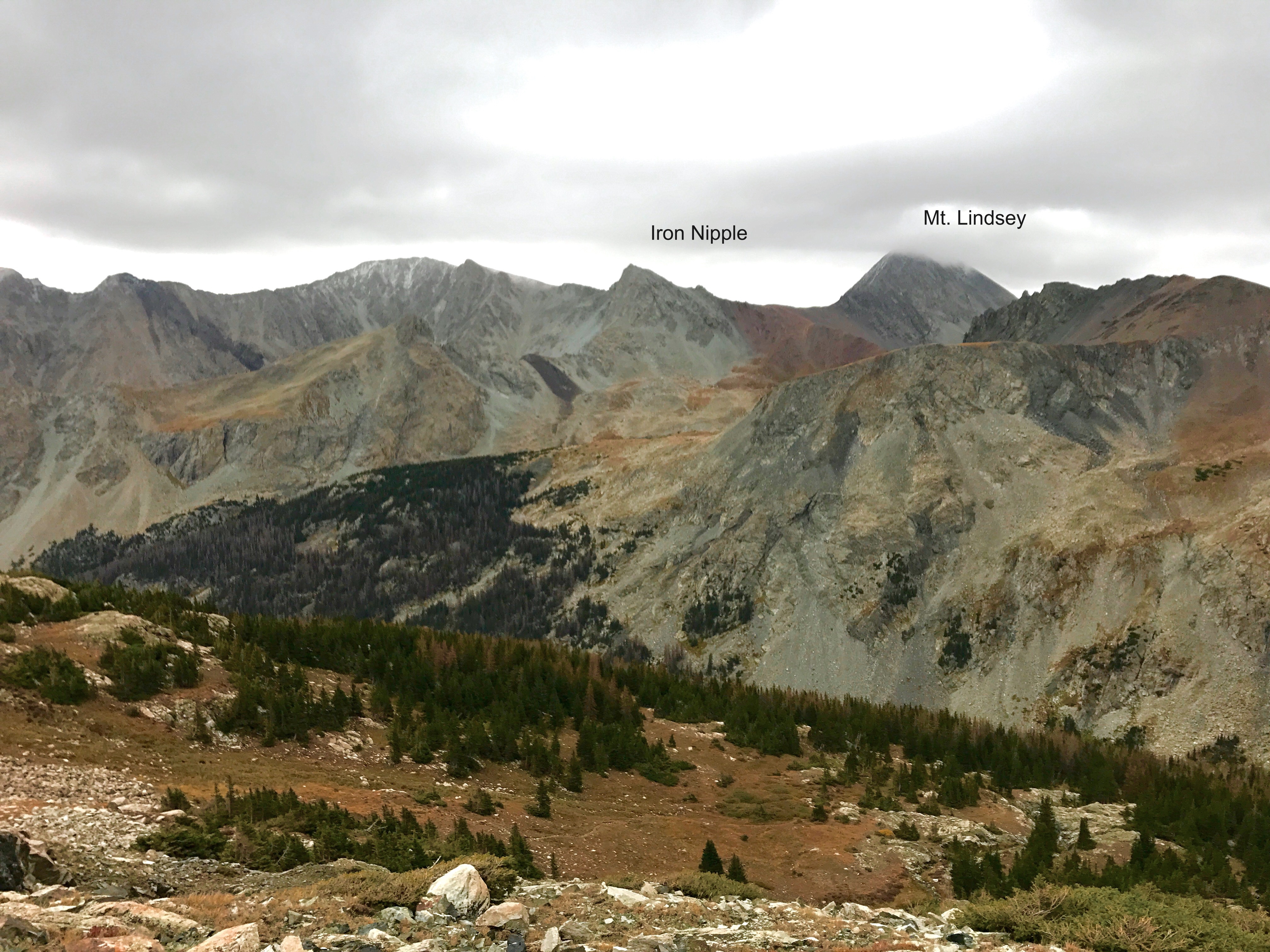
If you make the hike up, you can see Mt. Lindsey, Mt. Blanca, Mt. Ellingwood, and the Iron Nipple from Lilly Lake. From the Valley you can see all but Lindsey I believe. Lilly Lake offers amazing views, alpine environment and great fly fishing in the lake. There are lots of great places to camp just at tree line along the trail and just out of tree line as well. It is pretty much alway windy up there, so be prepared for a cold wind.
The Trail head starts at 10,400 feet with two parking areas.
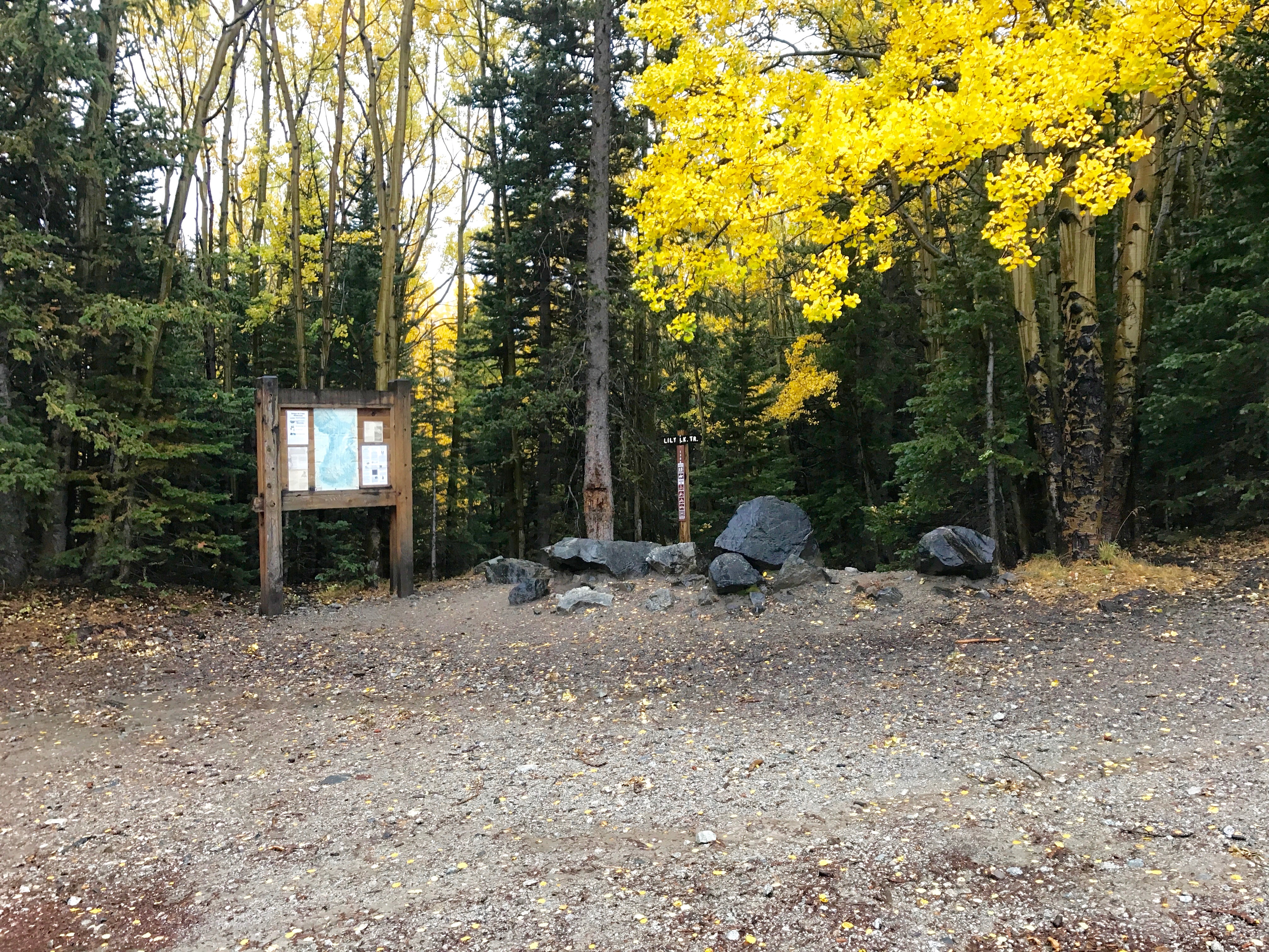

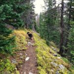
You begin hiking down what looks to be an old mining road of some kind as it still looks mostly like a road for awhile.

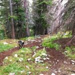
It is a mostly flat trail that leads directly up the valley towards the back side of Mt. Blanca and Mt. Ellingwood. It crosses little tributaries to the creek and follows it most of the way up the valley. About 1.25-1.5 miles in you will come to a sign that says Lilly Lake and a large trail that takes off. This must have been the old trail intersection as this trail leads nowhere except back to the main trail.
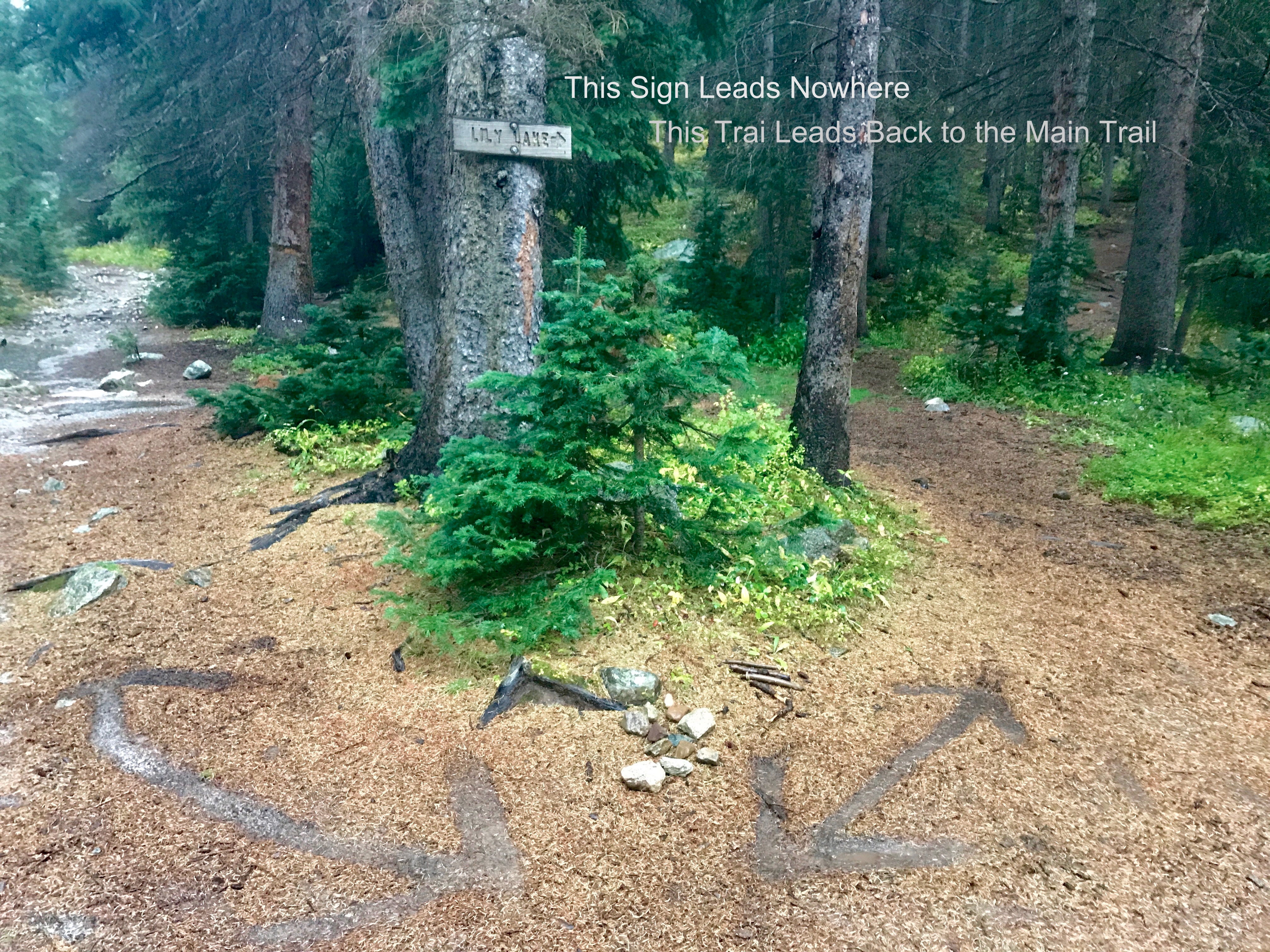
Take either trail and continue up the valley through a swampy area where it is hard to keep you feet dry (I failed going and coming) approx .25mi to the current Lilly Lake Trail Intersection.
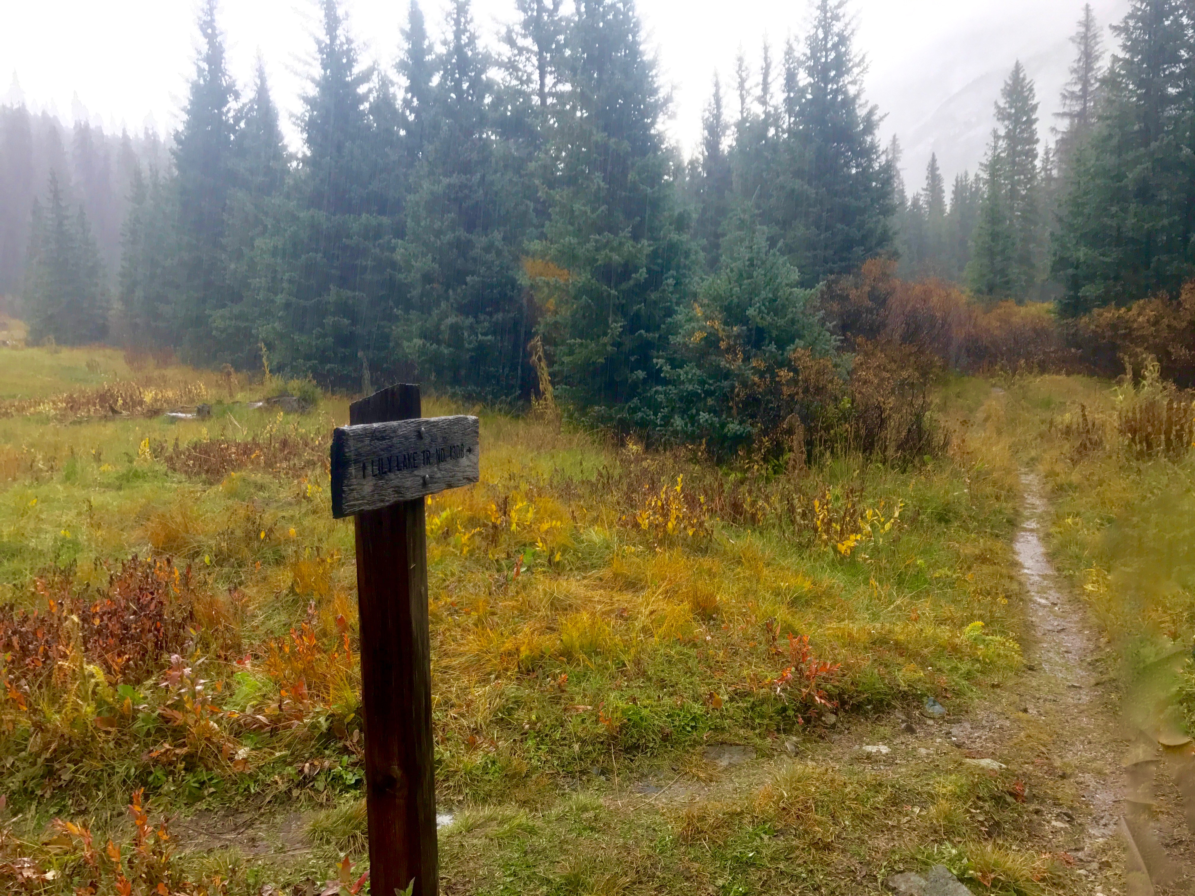
From the sign to the lake my GPS said it was 2.35 miles. It is approx 1900 feet of elevation from the valley floor up to the lake which is over 12,300 feet. The trail is in the trees most of the way up the side of the valley hill, and goes up steadily contouring making the hike not seem so steep.
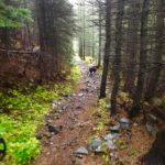
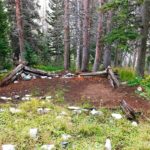
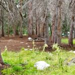

Right before you get out of treeline there are several options for good campsites. Most of the historical campsites, are now surrounded by dead beetle kill trees. There are many options in the area though, so choose wisely amongst all of those ‘widow-makers’. The last climb once you get out of tree line is fairly steep but not terribly long.

The lake sits at the base of 13,000 foot peaks and ridges. It is a pretty austere setting, but the views are amazing, and the fish routinely rose while we were eating lunch there. We huddled under a sleeping bag to keep warm up against a wind break of rocks. I have been here twice and it has been cold and windy both times (late June and mid September). You can see evidence of old mining with a big iron pipe they used to pipe water down from the lake to the valley below and where they probably blasted a crevice to get the pipe out over the edge.

From the Lake you can see the mountains ringing the valley including Mt. Lindsey and the Iron Nipple across the valley from the lake.
On our hike down the rain moved in around 3:30 that afternoon and fell steadily probably raining all night. Made me wish we had a tent or camper and were just spending the night listening to the rain. As it was the road was still not bad even when rain soaked and we went slowly down the mountain and back to Gardner. The fall colors were amazing on the drive in and out. We also saw lots of deer.

As a side note, on the way up you pass many other options for trails. These include the road that leads to Mosca Pass Trail before you get to the Huerfano State Wildlife Area, the Huerfano State Wildlife Area which has lots of camping and fishing. Then after you re-enter the National Forest there is a trailhead area where the Zapata Trail (Raspberry Trail) goes over the mountains to the west and the Huerfano Trail goes east for a loop with Ute and Strawberry Trails.